1960s Maps of Lake and Peninsula, Alaska
Explore 53 historic maps of Lake and Peninsula from the 1960s. These maps offer a rare glimpse into what life looked like during the 1960s — showing old roads, neighborhoods, homes, and landmarks that have changed or disappeared over time.
Whether you're researching your family's past, planning a metal detecting trip, or studying how Lake and Peninsula's landscape evolved across the 1960s, these high-resolution maps are a powerful tool for exploring the history of this region.
- Focus on a specific era: All maps on this page are from the 1960s, giving you a focused view of this time period.
- See what’s changed: Compare century-old streets, trails, and buildings to today's modern landscape using overlays and satellite layers.
- Research with precision: Use these maps for genealogy, historical research, land use analysis, or educational projects.
- View, download, or print: Maps are fully viewable online in high resolution, and can be downloaded or printed for your own records.
Start exploring Lake and Peninsula's history through authentic maps from the 1960s. This is your window into the past.
Lake and Peninsula, AK maps
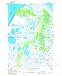
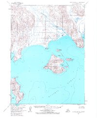
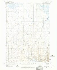
(53)- 1963 Map of Stepovak Bay D-2, 1967 Print
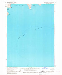 1963 Stepovak Bay D-21967 Print · USGSCoastal Alaska during the early sixties is captured here through detailed maritime soundings and shoreline topography. Researchers can trace the wild, roadless terrain surrounding Kuiukta Bay, Herring Lagoon, and the prominent point at Cape Ikti.2 unique versions available
 - 1963 Map of Chignik B-2, 1967 Print
 1963 Chignik B-21967 Print · USGSThe Alaska Peninsula coast in the early sixties reveals a busy maritime landscape centered on fishing and aviation. Researchers can locate the Seaplane Base Chignik, local Cannery sites, and family-named landmarks like Jerrys Point and Mensis Point.2 unique versions available
 - 1963 Map of Chignik C-3, 1967 Print
 1963 Chignik C-31967 Print · USGSThe Alaska Peninsula during the early 1960s reveals a vast, roadless wilderness dominated by high volcanic summits and complex glacial drainages. Geologists and explorers can trace the remote paths of Black Peak, Purple Lake, and the braided waters of Crater Creek.2 unique versions available
 - 1963 Map of Chignik A-4, 1967 Print
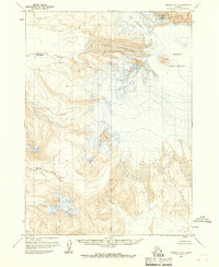
 1963 Chignik A-41967 Print · USGSThe Alaska Peninsula in the early 1960s is defined here by the massive ice fields descending from the heights of Mount Veniaminof. Researchers can trace the reach of Slim Glacier and Harpoon Glacier as they feed the West Fork Chignik River.3 unique versions available
 - 1963 Map of Ugashik B-6, 1967 Print
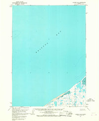
 1963 Ugashik B-61967 Print · USGSThe Bristol Bay coastline in the early sixties remains a wilderness of shifting tides and river networks. Researchers can trace the paths of the King Salmon River and Cynder River or locate a solitary Cabin along the remote banks.2 unique versions available
 - 1963 Map of Stepovak Bay C-5 and C-6, 1967 Print
 1963 Stepovak Bay C-5 and C-61967 Print · USGSThe Kupreanof Peninsula and Stepovak Bay are documented here in the early 1960s, showing the complex shoreline before modern changes. Researchers can trace coastal landmarks like Kupreanof Point, Hag Peak, and the tidal zones of Island Bay.2 unique versions available
 - 1963 Map of Chignik C-4, 1967 Print
 1963 Chignik C-41967 Print · USGSCoastal Alaska on the Bristol Bay shoreline is captured in the early sixties, showing a landscape defined by water and wetlands. Researchers can trace the drainage of Ungashik River and identify localized landmarks like Shake, Negro, and the Seal Islands.2 unique versions available
 - 1963 Map of Chignik B-1, 1967 Print
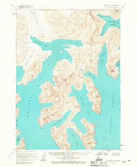
 1963 Chignik B-11967 Print · USGSThe Alaska coastline in the early sixties is revealed here as a wilderness of deep bays and steep peaks. Maritime researchers can trace soundings and shoreline details around Cape Kumliun, Anguvik Island, and the waters of Chignik Bay.2 unique versions available
 - 1963 Map of Stepovak Bay D-4, 1967 Print
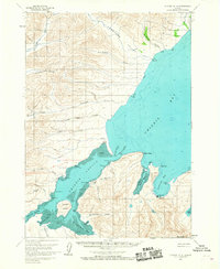
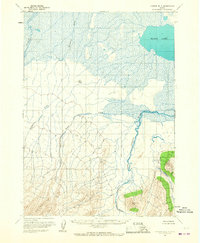
 1963 Stepovak Bay D-41967 Print · USGSCoastal life on the Alaska Peninsula comes into focus in the early sixties, centered on the village of Perryville. Genealogists and researchers can trace the coastal landscape around the Kametolook River, the designated Landing Area, and the Chiachi Islands.2 unique versions available
 - 1963 Map of Chignik A-6, 1967 Print
 1963 Chignik A-61967 Print · USGSThe Alaskan Peninsula during the early sixties reveals a landscape of complex river systems and glacial lakes. Geologists and local researchers can trace the intricate drainage of Sandy Lake and the braided paths of the Muddy River and Milky River.2 unique versions available
 - 1963 Map of Ugashik A-6, 1967 Print
 1963 Ugashik A-61967 Print · USGSThe Alaska Peninsula in the early sixties reveals a landscape shaped by volcanic heritage and braided water systems. Geologists and researchers can trace the drainages of Cinder River, Pumice Creek, and Lava Creek through vast wetlands.2 unique versions available
 - 1963 Map of Chignik A-2, 1967 Print
 1963 Chignik A-21967 Print · USGSThe Alaska Peninsula coastline was mapped in the early sixties, revealing a complex network of deep-water bays and high coastal peaks. Researchers can trace the rugged shoreline from Portage Bay to the southern reaches of Seal Bay and Kuiukta Bay.2 unique versions available
 - 1963 Map of Chignik B-5, 1967 Print
 1963 Chignik B-51967 Print · USGSThe Alaskan Peninsula south of Chignik is shown in the early sixties as a roadless wilderness dominated by massive ice fields. You can trace the drainage of Fog Glacier and Island Glacier as they feed remote waterways like Fog Creek and Blueberry Creek.2 unique versions available
 - 1963 Map of Chignik B-4, 1967 Print
 1963 Chignik B-41967 Print · USGSThe Chignik River valley during the early 1960s reveals a raw landscape of glacial peaks and extensive wetlands. Researchers can trace the flow from Black Lake through the West Fork and locate remote landmarks like Knife Peak and Cinder Glacier.2 unique versions available
 - 1963 Map of Chignik C-1, 1967 Print
 1963 Chignik C-11967 Print · USGSThe Alaska Peninsula coast comes into focus during the early 1960s, showing a wild landscape of braided rivers and deep maritime inlets. Researchers can trace remote topographic features like Cape Kumliun and locate isolated outposts including a Cabin near Portage Pass.2 unique versions available
 - 1963 Map of Bristol Bay, 1967 Print
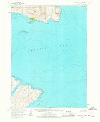
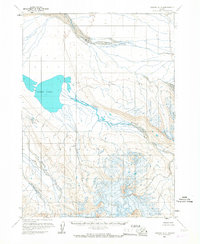
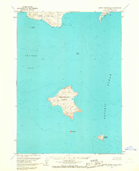
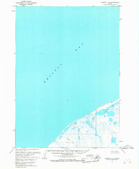
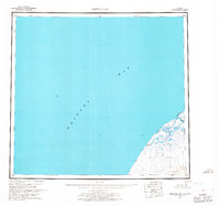 1963 Bristol Bay1967 Print · USGSThe Alaska Peninsula coastline at Bristol Bay is captured here in the early sixties, showing a landscape of coastal marshes and isolated outposts. Trace the locations of Sherry, Alfred, and Hook Lagoon along the banks of the Cinder River and Mud Creek.3 unique versions available
 - 1963 Map of Sutwik Island B-6, 1967 Print
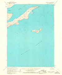
 1963 Sutwik Island B-61967 Print · USGSThe remote islands of Alaska's Chignik Bay come to life in this early 1960s coastal survey. Researchers can trace landforms like Nakchamik Island, identify a lonely Cabin on Unavikshak Island, and locate the dangerous Katmai Reef.2 unique versions available
 - 1963 Map of Bristol Bay A-2, 1967 Print
 1963 Bristol Bay A-21967 Print · USGSCoastal Alaska at the start of the 1960s reveals a raw landscape of shoreline hydrology and remote survey points along the Bering Sea. Trace the winding course of Reindeer Creek and identify landmarks like Hook Lagoon, Sherry, and Dubb.2 unique versions available
 - 1963 Map of Ugashik A-4, 1967 Print
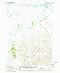
 1963 Ugashik A-41967 Print · USGSThe Alaska Peninsula remains an untouched wilderness in the early 1960s, defined by dramatic ridges and shifting watercourses. Researchers can trace the drainage of Volcano Creek as it flows into Mother Goose Lake and Needle Lake.2 unique versions available
 - 1963 Map of Chignik B-6, 1967 Print
 1963 Chignik B-61967 Print · USGSBristol Bay and the wild Alaska Peninsula are documented in the early sixties, showing a landscape without a single road or trail. Researchers can trace the untamed path of the Ocean River as it flows toward the coast or locate the basin of Wildman Lake.3 unique versions available
 - 1963 Map of Chignik A-5, 1967 Print
 1963 Chignik A-51967 Print · USGSThe volcanic reaches of the Alaska Peninsula are frozen in time during the early sixties. Scientists and researchers can study the primary ice fields of Cone Glacier and Fog Glacier surrounding the active Mount Veniaminof.2 unique versions available
 - 1963 Map of Chignik C-6, 1967 Print
 1963 Chignik C-61967 Print · USGSThe Alaska Peninsula coastline along Bristol Bay is captured here during the early sixties, showing a wilderness of water and tundra. Researchers can trace the winding path of Ocean River and locate Ilnik Lake and Three Hills.2 unique versions available
 - 1963 Map of Chignik D-4, 1967 Print
 1963 Chignik D-41967 Print · USGSThe Alaska Peninsula coastline meets the sea in the early 1960s, showing a wilderness defined by tides and marshes. Researchers can locate remote outposts like a lone Cabin and the site named Lilac along the Tidal Flats of Bristol Bay.2 unique versions available
 - 1963 Map of Chignik A-1, 1967 Print
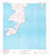
 1963 Chignik A-11967 Print · USGSThe Alaskan Peninsula coastline comes into focus in the early sixties, showing a landscape of deep fjords and isolated peaks. Researchers can trace the sounding depths and coastal landmarks from Tuliumnit Pt to the heights of Pudding and Foot.3 unique versions available
 - 1963 Map of Chignik D-3, 1967 Print
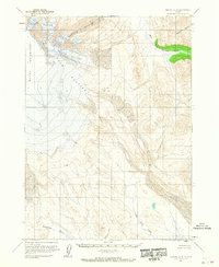
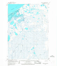
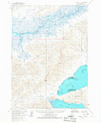
 1963 Chignik D-31967 Print · USGSThe northern coast of the Alaska Peninsula is captured here in the early sixties, centered on the inlet of Port Heiden. Local historians can trace the settlement at Meshik, locate the nearby Cem, and see the coastal lights on Chistiakof Island.2 unique versions available
Showing maps 1-25 of 53
Top cities of Lake and Peninsula
- Kokhanok historical maps
- Newhalen historical maps
- Nondalton historical maps
- Port Heiden historical maps
- Egegik historical maps
- Pilot Point historical maps
See more
Frequently asked questions
- What are the different types of historical maps available for Lake and Peninsula?
- What is the oldest map of Lake and Peninsula?
- Where can I purchase historical maps of Lake and Peninsula for my home or office?
- Where can I download high-res historical maps of Lake and Peninsula?
- Are there historical topographic maps available for Lake and Peninsula?
- Is there historical aerial imagery available for Lake and Peninsula?
- Where are historical maps of Lake and Peninsula sourced from?