
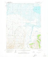
1963 Map of Chignik B-4
USGS Topo · Published 1967About this map
Black Lake dominates the upper corner of this coastal Alaska landscape, serving as a primary water source for the Chignik River. The drainage network includes Blueberry Creek and Fireweed Creek, which snake through marshy lowlands before the terrain rises sharply toward the southern peaks. This 1963 survey illustrates a transition from the extensive wetlands near the lake to the glaciated high country, where Cinder Glacier and Knife Peak define the mountainous skyline.
Find a feature on this map
10 named features on this map. Tap any name to fly to it.
Don’t see what you’re looking for? This feature index may not catch every label — zoom into the map to look around manually.
Map Details
Editions of this 1963 Chignik B-4 Map
2 editions found
Other maps of this area

1963 · Chignik C-3
USGS Topo · 1:63,360

1963 · Chignik A-4
USGS Topo · 1:63,360

1963 · Chignik C-4
USGS Topo · 1:63,360

1963 · Chignik B-5
USGS Topo · 1:63,360

1963 · Chignik A-5
USGS Topo · 1:63,360

1963 · Chignik A-3
USGS Topo · 1:63,360

1963 · Chignik B-3
USGS Topo · 1:63,360

1963 · Chignik C-5
USGS Topo · 1:63,360

1963 · Chignik
USGS Topo · 1:250,000
2020 · Chignik B-4 SW
USGS Topo · 1:25,000