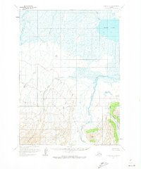
1963 Map of Chignik B-4
USGS Topo · Published 1973About this map
The Black Lake basin and the surrounding glacial highlands of the Alaska Peninsula dominate this 1963 survey. The landscape is defined by the hydrologic movement from the high ice of Crab Glacier and the slopes of Knife Peak down into the expansive waters of the lake. The Chignik River and its West Fork form a central drainage network, fed by numerous seasonal and perennial streams including Rapid Creek, Crater Creek, and the curiously named Bearskin Creek. The terrain transitions from the low-lying marshy areas near the lake to the prominent elevation of Rifle Butte. This map documents a wilderness prior to significant modern infrastructure, showing an unsurveyed landscape where land lines were predetermined by the Bureau of Land Management without field checking, preserving the raw state of the peninsula's interior as it was captured through mid-century photogrammetry.
Find a feature on this map
14 named features on this map. Tap any name to fly to it.
Don’t see what you’re looking for? This feature index may not catch every label — zoom into the map to look around manually.
Map Details
Editions of this 1963 Chignik B-4 Map
2 editions found
Other maps of this area

1963 · Chignik C-3
USGS Topo · 1:63,360

1963 · Chignik A-4
USGS Topo · 1:63,360

1963 · Chignik C-4
USGS Topo · 1:63,360

1963 · Chignik B-5
USGS Topo · 1:63,360

1963 · Chignik B-4
USGS Topo · 1:63,360

1963 · Chignik A-5
USGS Topo · 1:63,360

1963 · Chignik A-3
USGS Topo · 1:63,360

1963 · Chignik B-3
USGS Topo · 1:63,360

1963 · Chignik C-5
USGS Topo · 1:63,360

1963 · Chignik
USGS Topo · 1:250,000