
1963 Map of Chignik
USGS Topo · Published 1968About this map
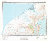
The Alaska Peninsula is defined here by the massive Mount Veniaminof, a glacier-capped peak feeding systems like the Cone Glacier and Fog Glacier. The landscape transitions from the volcanic heights of the Aleutian Range to the complex waterways of Chignik Lagoon and the fishing settlement of Chignik on the Pacific coast. This mid-century survey captures a region where survival and industry are tied to the water, evidenced by the Cannery at the coast and the Port Heiden Airfield providing a vital link to the north. Between Bristol Bay and the Pacific Ocean, the map reveals a network of remote outposts like Ilnik and Meshik, connected by rivers such as the Meshik River and Sandy River. For the researcher, the map details the infrastructure of the era, from a Radio Tower and Landing Strip to scattered Cabins and a Cem near the coast.
Find a feature on this map
170 named features on this map. Tap any name to fly to it.
Don’t see what you’re looking for? This feature index may not catch every label — zoom into the map to look around manually.
Map Details
Editions of this 1963 Chignik Map
3 editions found
Other maps of this area

1943 · Ugashik
USGS Topo · 1:250,000

1948 · Ugashik
USGS Topo · 1:250,000

1949 · Ugashik
USGS Topo · 1:250,000

1951 · Bristol Bay
USGS Topo · 1:250,000

1951 · Stepovak Bay
USGS Topo · 1:250,000

1951 · Sutwik Island
USGS Topo · 1:250,000

1953 · Port Moller
USGS Topo · 1:250,000

1963 · Stepovak Bay D-2
USGS Topo · 1:63,360

1963 · Chignik B-2
USGS Topo · 1:63,360

1963 · Chignik C-3
USGS Topo · 1:63,360