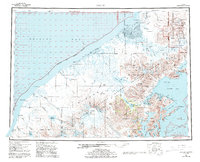
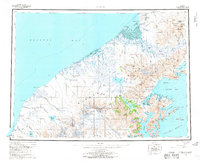
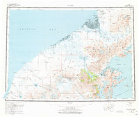
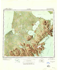
1963 Map of Chignik
USGS Topo · Published 1994About this map
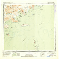
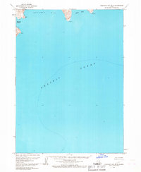
Aniakchak Crater and Mount Veniaminof dominate this coastal section of the Alaska Peninsula, illustrating a landscape shaped by volcanic activity and glacial runoff. Along the Pacific side, the fishing economy is evident at Chignik and Chignik Lagoon, where a Cannery and a small Cem reflect the local social and industrial history of the mid-20th century. To the north, the transition from the mountains to the lower reaches of Bristol Bay is marked by the Meshik River and the settlement of Meshik, which sits near the Port Heiden Airfield. The map details the intricate drainage systems of the Alaska Peninsula National Wildlife Refuge, featuring numerous named creeks such as Plenty Bear Creek and Birthday Creek that lead into Port Heiden.
Find a feature on this map
136 named features on this map. Tap any name to fly to it.
Don’t see what you’re looking for? This feature index may not catch every label — zoom into the map to look around manually.
Map Details
Editions of this 1963 Chignik Map
3 editions found
Other maps of this area
1943 · Ugashik
USGS Topo · 1:250,000

1948 · Ugashik
USGS Topo · 1:250,000

1949 · Ugashik
USGS Topo · 1:250,000

1951 · Bristol Bay
USGS Topo · 1:250,000

1951 · Stepovak Bay
USGS Topo · 1:250,000
1951 · Sutwik Island
USGS Topo · 1:250,000

1953 · Port Moller
USGS Topo · 1:250,000
1963 · Stepovak Bay D-2
USGS Topo · 1:63,360
1963 · Chignik B-2
USGS Topo · 1:63,360
1963 · Chignik C-3
USGS Topo · 1:63,360