Old Maps of Alaska
Explore old maps of Alaska, spanning from 1899 to today. These high-resolution historic maps reveal how streets, neighborhoods, landmarks, and natural features evolved over time — perfect for genealogy, metal detecting, research, and local history exploration.
What you can do with these maps:
- See how Alaska changed over time: Compare historical maps to modern-day views to trace roads, homesites, rail lines & more.
- View detailed metadata: Each map includes creators, publishers, year, scale, and archive source.
- Overlay maps with satellite & LiDAR: Visualize the past alongside modern tools to explore terrain & human change.
- Trusted historical sources: Maps sourced from the USGS, Library of Congress, and other archives.
- Access maps your way: View online, download high-res files, or order prints for personal or research use.
Start exploring old maps of Alaska to uncover forgotten places, hidden landmarks, and the deep history beneath your feet.
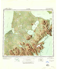
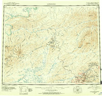
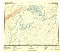
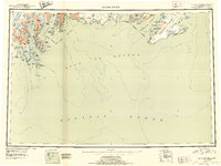
Alaska maps
- 1899 Map of Fortymile, 1902 Print
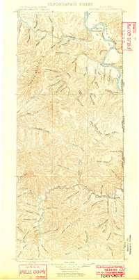 1899 Fortymile1902 Print · USGSThe Alaska-Yukon borderlands come into focus at the end of the nineteenth century during the height of the northern gold rushes. Local historians can trace early mining outposts and frontier hubs like Eagle City, Star City, and Seventymile along the Yukon River.3 unique versions available
 - 1907 Map of Casadepaga
 1907 Casadepaga1907 Print · USGSThe Seward Peninsula mining frontier is captured here at the height of early exploration, featuring the route of the Council City and Solomon River Railroad. Genealogists and historians can trace the early transit network and remote outposts like the Roadhouse and Mt Dixon.2 unique versions available
 - 1907 Map of Solomon
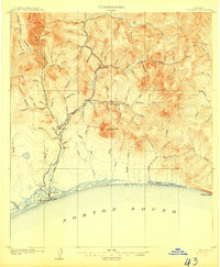 1907 Solomon1907 Print · USGSCoastal Alaska during the gold rush era reveals a landscape of rapid industrialization along the Norton Sound. You can trace the Council City and Solomon River RR from Solomon up to the Big Hurrah Mine and find numerous gold-bearing gulches.2 unique versions available
 - 1943 Map of Fort Randall, 1954 Print
 1943 Fort Randall1954 Print · USGSThe Alaska Peninsula and its wartime outposts are documented in this mid-forties survey. Researchers can trace the military footprint at Thornbrough Air Force Base and maritime hubs like King Cove and Belkofski.7 unique versions available
 - 1943 Map of Ugashik, 1958 Print
 1943 Ugashik1958 Print · USGSThe remote Alaska Peninsula is captured here in the 1940s, showing a wilderness of volcanic peaks and vast coastal drainages. You can trace early 20th-century outposts like Pilot Point and Lee Cabin set against landmarks like Mt Peulik and the waters of Becharof Lake.3 unique versions available
 - 1943 Map of Sumdum B-4, 1979 Print
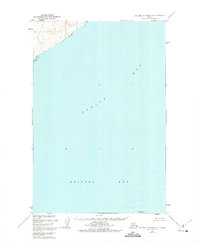
 1943 Sumdum B-41979 Print · USGSSoutheastern Alaska's intricate coastline is documented here during the mid-century, featuring the deep waters of Port Houghton. Researchers can locate the Walter Island Cabin and trace the drainage of the Chuck River into The Salt Chuck.
 - 1944 Map of Cold Bay Sheet No. 20 of 25
 1944 Cold Bay Sheet No. 20 of 251944 Print · USGSThe southwestern tip of the Alaska Peninsula is documented here during the wartime mobilization of the mid-forties. Researchers can trace the steep coastal terrain and offshore features like Amagat Island, Cape Tachilni, and the peaks around Morzhovoi Bay.
 - 1944 Map of Cold Bay Sheet No. 1 of 25
 1944 Cold Bay Sheet No. 1 of 251944 Print · USGSThe Aleutian coast comes into focus during the mid-forties as military engineers charted the strategic waters of the North Pacific. Researchers can trace the complex shoreline of Opperl Island where the Bering Sea meets the tides of Izembek Bay.
 - 1944 Map of Cold Bay Sheet No. 2 of 25
 1944 Cold Bay Sheet No. 2 of 251944 Print · USGSThe Alaska Peninsula's coastal terrain during the Aleutian Islands Campaign is meticulously recorded in this wartime survey. Genealogists and researchers can trace the shoreline of Moffet Bay and locate landmarks like Neumann Island and Moffet Point.
 - 1944 Map of Kenai, 1954 Print
 1944 Kenai1954 Print · USGSThe Kenai Peninsula and Cook Inlet are captured here during a period of postwar growth, just as the regional road system began to expand. Genealogists and historians can trace early settlements and family landmarks such as Salamatoff, Stelters Ranch, and the Snug Harbor Cannery.4 unique versions available
 - 1945 Map of Livengood
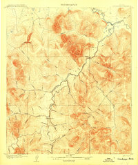
 1945 Livengood1945 Print · USGSThe Alaska Interior at the end of World War II reveals a landscape of mining camps and river outposts. Trace the early road network from Chatanika to the gold fields of Livengood, or locate the site of Fort Hamlin.4 unique versions available
 - 1945 Map of Barrow, 1954 Print
 1945 Barrow1954 Print · USGSThe northernmost tip of Alaska is captured here in the mid-1940s as the region became a focus for naval energy reserves. Researchers can locate the village of Nuwuk, the strategic Barrow Airfield, and the Will Rogers and Wiley Post Memorial.
 - 1945 Map of Nushagak Bay, 1954 Print
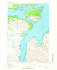
 1945 Nushagak Bay1954 Print · USGSNushagak Bay and the sprawling Alaskan coastline are captured in the mid-1940s, highlighting a landscape defined by salmon fishing and tidal waters. Researchers can locate remote outposts like Old Saltery, the busy Nushagak Cannery, and the coastal settlement of Clarks Point.
 - 1945 Map of Nulato, 1954 Print
 1945 Nulato1954 Print · USGSThe Yukon and Koyukuk rivers serve as the lifeblood of this Alaskan interior region during the mid-forties. Researchers can trace the traditional Kaltag Portage and locate established riverside settlements like Nulato, Galena, and the village at Koyukuk.2 unique versions available
 - 1946 Map of Blying Sound, 1954 Print
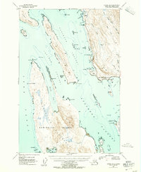
 1946 Blying Sound1954 Print · USGSThe Kenai Peninsula coastline at the end of World War II reveals a wilderness of massive ice fields and deep fjords. Trace the glacial reaches of the Harding Ice Field and locate coastal landmarks like Caines Head and Cape Resurrection.2 unique versions available
 - 1946 Map of Lake Clark, 1954 Print
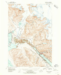
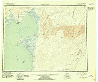
 1946 Lake Clark1954 Print · USGSInterior Alaska during the mid-forties and early fifties reveals a remote landscape of glacial lakes and mountain peaks. You can trace early settlements at Nondalton, find the Old Village trail network, and locate the Tanalian Point Landing Field near the shores of Lake Clark.2 unique versions available
 - 1946 Map of Seldovia C-5, 1958 Print
 1946 Seldovia C-51958 Print · USGSThe coastal settlement of Homer and the lower Kenai Peninsula are captured here just after the war as the regional road network began to solidify. Researchers can trace early infrastructure like the Sterling Highway, a shoreline Coal Mine, and the Seaplane Anchorage.
 - 1946 Map of Seldovia D-5, 1958 Print
 1946 Seldovia D-51958 Print · USGSThe Kenai Peninsula coastline comes into focus just after the war as the modern road network begins to take shape. Researchers can trace the early layout of Anchor Point and identify coastal landmarks like Cape Starichkof and the Sterling Highway.
 - 1947 Map of Juneau B-3, 1955 Print
 1947 Juneau B-31955 Print · USGSThe coastal waters north of Juneau come alive in the late 1940s, showing a maritime landscape of channels and remote landings. Researchers can trace early infrastructure like the lighthouse at Point Retreat, the small settlement at Dotsons Landing, and the original Glacier Highway route.2 unique versions available
 - 1947 Map of Juneau B-2, 1955 Print
 1947 Juneau B-21955 Print · USGSThe industrial waterfront of Juneau and Douglas comes to life in the years following the war. Genealogists and historians can trace mining sites like the Alaska-Juneau Mill, the development of the Juneau Airport, and the early layout of Treadwell.2 unique versions available
 - 1947 Map of Russian Mission, 1957 Print
 1947 Russian Mission1957 Print · USGSSouthwest Alaska in the late 1940s is mapped here as a vast network of river settlements and mountain outposts. Researchers can trace historic river life and early aviation at Russian Mission, Kako Air Field, and Crow Village.2 unique versions available
 - 1947 Map of Kodiak D-3, 1966 Print
 1947 Kodiak D-31966 Print · USGSThe Kodiak Archipelago's intricate coastlines and islands are captured here just after the mid-century. Trace the maritime geography of Port Lions and the mountainous stretches of the Kodiak National Wildlife Refuge near Whale Island.3 unique versions available
 - 1947 Map of Hagemeister Island C-7, 1972 Print
 1947 Hagemeister Island C-71972 Print · USGSThe Bering Sea coastline at the edge of the 1940s is defined by its isolation and specialized outposts. Researchers can locate the early Weather Station and Landing Strip at Cape Newenham, along with a single Cabin and the peaks of Jagged Mtn.
 - 1947 Map of Hagemeister Island D-2, 1975 Print
 1947 Hagemeister Island D-21975 Print · USGSThe northern reaches of Bristol Bay appear here in the late 1940s, providing a detailed record of the Alaskan coast before modern development. Researchers can trace the mouth of the Quigmy R and locate the solitary landmark of High Island among the soundings of Togiak Bay.2 unique versions available
 - 1948 Map of Norton Bay, 1954 Print
 1948 Norton Bay1954 Print · USGSThe eastern shores of Norton Sound are captured here during the late 1940s, highlighting the coastal reservations and inland mountain trails. Trace the old travel routes between Isaac Roadhouse, Egavik, and remote outposts like Old Woman Cabin.2 unique versions available
Showing maps 1-25
Top cities of Alaska
- Anchorage historical maps
- Fairbanks historical maps
- Juneau historical maps
- Badger historical maps
- Wasilla historical maps
- Sitka historical maps
See more
Top boroughs of Alaska
Frequently asked questions
- What are the different types of historical maps available for Alaska?
- What is the oldest map of Alaska?
- Where can I purchase historical maps of Alaska for my home or office?
- Where can I download high-res historical maps of Alaska?
- Are there historical topographic maps available for Alaska?
- Is there historical aerial imagery available for Alaska?
- Where are historical maps of Alaska sourced from?