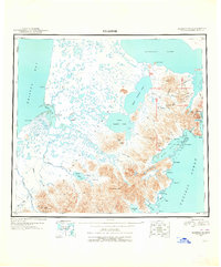
1949 Map of Ugashik
USGS Topo · Published 1949About this map
Pilot Point and Kanatak anchor this mid-century survey of the Alaska Peninsula, where the landscape is defined by massive tidal flats, intricate river systems, and volcanic peaks. The drainage patterns of the Ugashik River, Dog Salmon River, and Cinder River illustrate the complex hydrology feeding into Bristol Bay. To the east, the terrain rises sharply toward the Aleutian Range, featuring prominent landmarks like the massive Mt Chiginagak and Mt Peulik near the shores of Becharof Lake. Remote outposts such as Lee's Cabin and the unusual geological formations at The Gas Rocks provide evidence of early 20th-century habitation and exploration. The transition from the coastal lowlands to the mountainous Pacific interior is captured through the deep waters of Upper Ugashik Lake and Lower Ugashik Lake, providing a look at this region before modern development.
Find a feature on this map
87 named features on this map. Tap any name to fly to it.
Don’t see what you’re looking for? This feature index may not catch every label — zoom into the map to look around manually.
Map Details
Editions of this 1949 Ugashik Map
2 editions found
Historical Maps of Pilot Point Through Time
4 maps found