
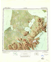
1945 Map of Nushagak Bay
USGS Topo · Published 1954About this map
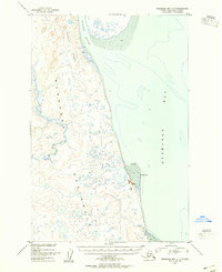
Nushagak Peninsula dominates this coastal survey, reaching south into Bristol Bay during the mid-1940s. The region's economy is clearly centered on the commercial fishing and processing industry, anchored by the Nushagak Cannery and several smaller cannery sites near Clarks Point and Ekuk Spit. These coastal outposts, along with the Old Saltery on the Snake River, illustrate the seasonal and industrial life of the bay before modern infrastructure. Inland, the map traces the winding paths of the Igushik River and Weary River through a landscape punctuated by isolated cabins and small settlements like Kulukak and Quek. The presence of Nichols Hills and Acorn Peak provides a sense of the varied terrain surrounding Nushagak Bay, while Round Island stands as a lonely sentinel in the western waters, marking a transition toward the more remote reaches of the coastline.
Find a feature on this map
35 named features on this map. Tap any name to fly to it.
Don’t see what you’re looking for? This feature index may not catch every label — zoom into the map to look around manually.
Map Details
Editions of this 1945 Nushagak Bay Map
This is the sole edition of this map. No revisions or reprints were ever made.
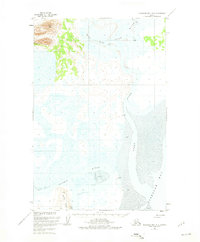
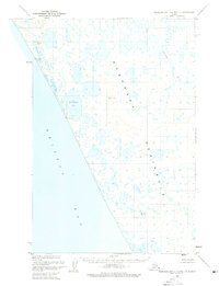
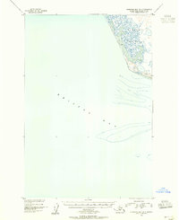
Other maps of this area
1943 · Ugashik
USGS Topo · 1:250,000

1948 · Ugashik
USGS Topo · 1:250,000

1948 · Nushagak Bay D-4
USGS Topo · 1:63,360
1948 · Nushagak Bay D-3
USGS Topo · 1:63,360
1948 · Nushagak Bay C-4 And C-5
USGS Topo · 1:63,360

1948 · Hagemeister Island C-1
USGS Topo · 1:63,360

1949 · Ugashik
USGS Topo · 1:250,000

1949 · Nushagak Bay
USGS Topo · 1:250,000
1950 · Nushagak Bay B-4
USGS Topo · 1:63,360
1950 · Nushagak Bay C-3
USGS Topo · 1:63,360