Old Maps of Unorganized Borough, Alaska
Explore old maps of Unorganized Borough, spanning from 1899 to today. These high-resolution historic maps reveal how streets, neighborhoods, landmarks, and natural features evolved over time — perfect for genealogy, metal detecting, research, and local history exploration.
What you can do with these maps:
- See how Unorganized Borough changed over time: Compare historical maps to modern-day views to trace roads, homesites, rail lines & more.
- View detailed metadata: Each map includes creators, publishers, year, scale, and archive source.
- Overlay maps with satellite & LiDAR: Visualize the past alongside modern tools to explore terrain & human change.
- Trusted historical sources: Maps sourced from the USGS, Library of Congress, and other archives.
- Access maps your way: View online, download high-res files, or order prints for personal or research use.
Start exploring old maps of Unorganized Borough to uncover forgotten places, hidden landmarks, and the deep history beneath your feet.
Unorganized Borough, AK maps
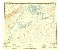
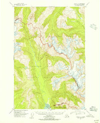
- 1899 Map of Fortymile, 1902 Print
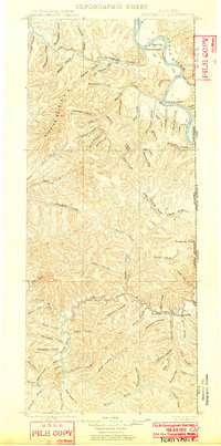 1899 Fortymile1902 Print · USGSThe Alaska-Yukon borderlands come into focus at the end of the nineteenth century during the height of the northern gold rushes. Local historians can trace early mining outposts and frontier hubs like Eagle City, Star City, and Seventymile along the Yukon River.3 unique versions available
 - 1907 Map of Casadepaga
 1907 Casadepaga1907 Print · USGSThe Seward Peninsula mining frontier is captured here at the height of early exploration, featuring the route of the Council City and Solomon River Railroad. Genealogists and historians can trace the early transit network and remote outposts like the Roadhouse and Mt Dixon.2 unique versions available
 - 1907 Map of Solomon
 1907 Solomon1907 Print · USGSCoastal Alaska during the gold rush era reveals a landscape of rapid industrialization along the Norton Sound. You can trace the Council City and Solomon River RR from Solomon up to the Big Hurrah Mine and find numerous gold-bearing gulches.2 unique versions available
 - 1943 Map of Sumdum B-4, 1979 Print
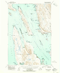
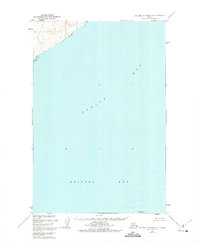
 1943 Sumdum B-41979 Print · USGSSoutheastern Alaska's intricate coastline is documented here during the mid-century, featuring the deep waters of Port Houghton. Researchers can locate the Walter Island Cabin and trace the drainage of the Chuck River into The Salt Chuck.
 - 1945 Map of Livengood
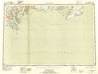
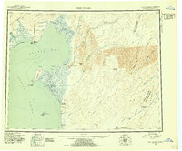
 1945 Livengood1945 Print · USGSThe Alaska Interior at the end of World War II reveals a landscape of mining camps and river outposts. Trace the early road network from Chatanika to the gold fields of Livengood, or locate the site of Fort Hamlin.4 unique versions available
 - 1945 Map of Nushagak Bay, 1954 Print
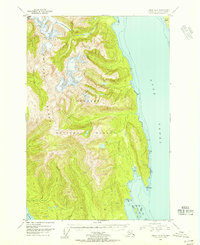
 1945 Nushagak Bay1954 Print · USGSNushagak Bay and the sprawling Alaskan coastline are captured in the mid-1940s, highlighting a landscape defined by salmon fishing and tidal waters. Researchers can locate remote outposts like Old Saltery, the busy Nushagak Cannery, and the coastal settlement of Clarks Point.
 - 1945 Map of Nulato, 1954 Print
 1945 Nulato1954 Print · USGSThe Yukon and Koyukuk rivers serve as the lifeblood of this Alaskan interior region during the mid-forties. Researchers can trace the traditional Kaltag Portage and locate established riverside settlements like Nulato, Galena, and the village at Koyukuk.2 unique versions available
 - 1946 Map of Blying Sound, 1954 Print
 1946 Blying Sound1954 Print · USGSThe Kenai Peninsula coastline at the end of World War II reveals a wilderness of massive ice fields and deep fjords. Trace the glacial reaches of the Harding Ice Field and locate coastal landmarks like Caines Head and Cape Resurrection.2 unique versions available
 - 1946 Map of Lake Clark, 1954 Print
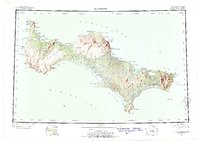
 1946 Lake Clark1954 Print · USGSInterior Alaska during the mid-forties and early fifties reveals a remote landscape of glacial lakes and mountain peaks. You can trace early settlements at Nondalton, find the Old Village trail network, and locate the Tanalian Point Landing Field near the shores of Lake Clark.2 unique versions available
 - 1947 Map of Juneau B-3, 1955 Print
 1947 Juneau B-31955 Print · USGSThe coastal waters north of Juneau come alive in the late 1940s, showing a maritime landscape of channels and remote landings. Researchers can trace early infrastructure like the lighthouse at Point Retreat, the small settlement at Dotsons Landing, and the original Glacier Highway route.2 unique versions available
 - 1947 Map of Russian Mission, 1957 Print
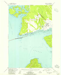
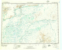 1947 Russian Mission1957 Print · USGSSouthwest Alaska in the late 1940s is mapped here as a vast network of river settlements and mountain outposts. Researchers can trace historic river life and early aviation at Russian Mission, Kako Air Field, and Crow Village.2 unique versions available
 - 1947 Map of Hagemeister Island C-7, 1972 Print
 1947 Hagemeister Island C-71972 Print · USGSThe Bering Sea coastline at the edge of the 1940s is defined by its isolation and specialized outposts. Researchers can locate the early Weather Station and Landing Strip at Cape Newenham, along with a single Cabin and the peaks of Jagged Mtn.
 - 1947 Map of Hagemeister Island D-2, 1975 Print
 1947 Hagemeister Island D-21975 Print · USGSThe northern reaches of Bristol Bay appear here in the late 1940s, providing a detailed record of the Alaskan coast before modern development. Researchers can trace the mouth of the Quigmy R and locate the solitary landmark of High Island among the soundings of Togiak Bay.2 unique versions available
 - 1948 Map of Norton Bay, 1954 Print
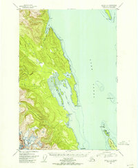
 1948 Norton Bay1954 Print · USGSThe eastern shores of Norton Sound are captured here during the late 1940s, highlighting the coastal reservations and inland mountain trails. Trace the old travel routes between Isaac Roadhouse, Egavik, and remote outposts like Old Woman Cabin.2 unique versions available
 - 1948 Map of St Lawrence, 1954 Print
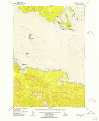
 1948 St Lawrence1954 Print · USGSSaint Lawrence Island in the late 1940s is shown as a land of seasonal movement and subsistence living. Researchers can trace historic sites like the Kukuliak (Old Village Site), locate Ataaka's Camp, and follow the established Winter Trail across the island.7 unique versions available
 - 1948 Map of Pribilof Islands, 1955 Print
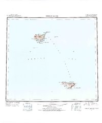 1948 Pribilof Islands1955 Print · USGSThe remote Pribilof Islands are documented here just after the war, showing the essential settlements and coastal geography of this Bering Sea archipelago. Researchers can trace the landing sites and terrain at St Paul, St. George, Village Cove, and Garden Cove.4 unique versions available
 - 1948 Map of Juneau C-5, 1956 Print
 1948 Juneau C-51956 Print · USGSThe Chilkat Range and Glacier Bay wilderness are captured here during the late 1940s, highlighting the border of the Tongass National Forest. Researchers can trace the rugged divide from Volcanic Peak down to the Tidal Flat at Excursion Inlet.2 unique versions available
 - 1948 Map of Juneau B-4, 1956 Print
 1948 Juneau B-41956 Print · USGSSoutheast Alaska’s coastal wilderness is captured in the late 1940s, showing the meeting of mountain and sea before modern infrastructure. Trace the shoreline of Lynn Canal to find isolated landmarks like Pt Howard, Lincoln Island, and the Lynn Sisters.2 unique versions available
 - 1948 Map of Juneau A-3, 1956 Print
 1948 Juneau A-31956 Print · USGSAdmiralty Island in the late 1940s was a hub of remote industry and rugged coastal activity. Researchers can trace the maritime infrastructure of the Hawk Inlet Cannery or locate isolated resource sites like the Admiralty Mine and its hillside Tramway.
 - 1948 Map of Juneau B-6, 1956 Print
 1948 Juneau B-61956 Print · USGSCoastal Alaska at the dawn of the fifties reveals a landscape defined by water and wilderness. Local historians can trace the early infrastructure of Gustavus, from the Gustavus Airfield to landmarks like Bartlett Cove and Pleasant Island.4 unique versions available
 - 1948 Map of Sitka B-3, 1956 Print
 1948 Sitka B-31956 Print · USGSThe Alexander Archipelago in the late 1940s reveals a complex network of glacial fjords and forested islands before modern development. Trace the maritime landscape through Kelp Bay to find isolated Cabins and named landmarks like Pond Island.
 - 1948 Map of Juneau C-4, 1956 Print
 1948 Juneau C-41956 Print · USGSThe waters of the northern Alexander Archipelago are captured here in the late 1940s, highlighting the maritime navigation and coastal terrain of Southeast Alaska. Maritime historians and researchers can trace landmarks like Vanderbilt Reef Light, the small Cabin sites, and the islands of Lincoln Island and the Lynn Sisters.
 - 1948 Map of Juneau A-4, 1956 Print
 1948 Juneau A-41956 Print · USGSThe maritime junction of Southeast Alaska is captured here in the mid-twentieth century as navigation and coastal life relied on isolated outposts. Researchers can locate early coastal landmarks such as the Light at Swanson Harbor, Pt Couverden, and a Cem on the northern shore.4 unique versions available
 - 1948 Map of Sitka D-1, 1956 Print
 1948 Sitka D-11956 Print · USGSAdmiralty Island and the Seymour Canal appear here during the late 1940s, showing the remote Alaskan coast before modern navigational updates. Researchers can locate early wilderness landmarks like the Bear Observatory and isolated structures such as the Shelter Cabin near Windfall Harbor.
 - 1948 Map of Sitka B-1, 1956 Print
 1948 Sitka B-11956 Print · USGSAdmiralty Island's coastal wilderness was being meticulously charted just after the war, recording the remote outposts of the Alexander Archipelago. Researchers can locate coastal cabins and landmarks like Cannery Cove, Donkey Bay, and the San Juan Islands.
Showing maps 1-25
Top cities of Unorganized Borough
- Bethel historical maps
- Unalaska historical maps
- Valdez historical maps
- Nome historical maps
- Dillingham historical maps
- Cordova historical maps
See more
Frequently asked questions
- What are the different types of historical maps available for Unorganized Borough?
- What is the oldest map of Unorganized Borough?
- Where can I purchase historical maps of Unorganized Borough for my home or office?
- Where can I download high-res historical maps of Unorganized Borough?
- Are there historical topographic maps available for Unorganized Borough?
- Is there historical aerial imagery available for Unorganized Borough?
- Where are historical maps of Unorganized Borough sourced from?