1950s Maps of Unorganized Borough, Alaska
Explore 1,617 historic maps of Unorganized Borough from the 1950s. These maps offer a rare glimpse into what life looked like during the 1950s — showing old roads, neighborhoods, homes, and landmarks that have changed or disappeared over time.
Whether you're researching your family's past, planning a metal detecting trip, or studying how Unorganized Borough's landscape evolved across the 1950s, these high-resolution maps are a powerful tool for exploring the history of this region.
- Focus on a specific era: All maps on this page are from the 1950s, giving you a focused view of this time period.
- See what’s changed: Compare century-old streets, trails, and buildings to today's modern landscape using overlays and satellite layers.
- Research with precision: Use these maps for genealogy, historical research, land use analysis, or educational projects.
- View, download, or print: Maps are fully viewable online in high resolution, and can be downloaded or printed for your own records.
Start exploring Unorganized Borough's history through authentic maps from the 1950s. This is your window into the past.
Unorganized Borough, AK maps
(1,617)- 1950 Map of Medfra
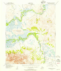
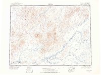 1950 Medfra1950 Print · USGSThe Alaskan interior in the mid-twentieth century was a land of river navigation and seasonal trails. You can trace the routes between the Slow Fork Roadhouse, the Nixon Fork Mine, and the river settlement at Medfra.2 unique versions available
 - 1950 Map of Russian Mission
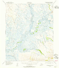
 1950 Russian Mission1950 Print · USGSThe Yukon-Kuskokwim Delta region comes alive in the early post-war era, showing the river-bound lifeways of the Alaskan interior. Local historians and genealogists can trace remote outposts like Russian Mission, Dogfish Village, and Nyac, or locate family sites like Phillips Broe.
 - 1950 Map of Kotzebue C-6
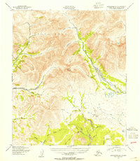
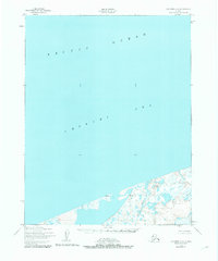 1950 Kotzebue C-61950 Print · USGSThe northern Alaskan coast at the start of the 1950s reveals a sparse landscape of wetlands and isolated outposts. Genealogists and researchers can trace the coastal settlements of Kividlo and Singeak or follow the course of the Kalik River to the sea.3 unique versions available
 - 1950 Map of Sitka D-8
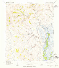
 1950 Sitka D-81950 Print · USGSYakobi and Chichagof Islands appear in the late 1940s, revealing the intricate coastline of the Tongass National Forest before modern development. Maritime researchers and genealogists can trace early landmarks like White Sulphur Springs, Surge Bay Light, and the Bohemia Basin.2 unique versions available
 - 1950 Map of Middleton Island
 1950 Middleton Island1950 Print · USGSThe Gulf of Alaska's maritime approaches and remote island outposts are documented here at the start of the 1950s. Researchers can trace the layout of the Landing field on Middleton Island or locate hazards like Sea Ranger Reef near Cape St Elias.
 - 1950 Map of Sleetmute
 1950 Sleetmute1950 Print · USGSThe Kuskokwim River corridor in the 1950s was a hub of interior Alaskan trade, where commerce relied on seasonal waterways and winter trails. Researchers can trace historic river outposts like Mellicks Trading Post, the Iditarod Winter Trail, and the remnants of Kolmakof Fort (Ruins).2 unique versions available
 - 1950 Map of McGrath
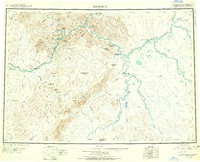
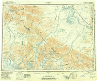
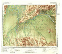
 1950 McGrath1950 Print · USGSThe Kuskokwim River valley and the Alaska Range foothills appear here at the dawn of the fifties. Trace the old interior supply routes through McGrath and Nikolai, or locate remote landmarks like Farewell Mtn Roadhouse and Rainy Pass.
 - 1950 Map of Bethel
 1950 Bethel1950 Print · USGSThe Kuskokwim River region in the mid-twentieth century reveals a landscape of remote riverside villages and emerging aviation hubs. Researchers can trace traditional routes like the Winter Trail and locate family-named peaks such as Fisher Dome and Gemuk Mtn.3 unique versions available
 - 1950 Map of Tanacross
 1950 Tanacross1950 Print · USGSEastern Alaska's interior in the mid-twentieth century was a landscape of pioneering roads and traditional river settlements. Genealogists and historians can locate the Tetlin Indian Reservation, the early layout of Tok Junction, and remote outposts like Fortymile House.2 unique versions available
 - 1950 Map of Craig D-3, 1953 Print
 1950 Craig D-31953 Print · USGSSoutheast Alaska in the mid-twentieth century is captured here as a maritime and mountain wilderness. Researchers can trace the original shorelines and interior basins including Sweetwater Lake, Coffman Cove, and the winding Thorne River.2 unique versions available
 - 1950 Map of Craig B-1, 1953 Print
 1950 Craig B-11953 Print · USGSThe maritime landscape of Prince of Wales Island is captured here in the early fifties, showcasing the intricate shoreline of the Tongass National Forest. Researchers can trace historic coastal landmarks and protected inlets like Chasina Anchorage, Saltery Cove, and Clover Lake.2 unique versions available
 - 1950 Map of Talkeetna, 1954 Print
 1950 Talkeetna1954 Print · USGSThe Susitna Valley and the foothills of the Alaska Range appear in this mid-century survey as a frontier of remote lodges and rail-side outposts. You can trace the path of The Alaska Railroad through Talkeetna and locate vanished settlements like Sunflower.2 unique versions available
 - 1950 Map of Nabesna, 1954 Print
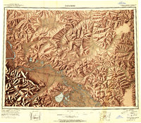
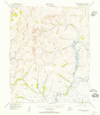
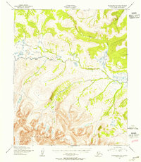
 1950 Nabesna1954 Print · USGSInterior Alaska in the early fifties shows a rugged transition from mountain glaciers to river-basin settlements before statehood. Researchers can trace the remote mining outposts of Nabesna and Chisana or locate old airstrips like Reeve Field and Northway Landing Field.4 unique versions available
 - 1950 Map of Fairbanks, 1955 Print
 1950 Fairbanks1955 Print · USGSMid-century Interior Alaska centers on the growing hub of Fairbanks and the massive military infrastructure that reshaped the region. Trace the path of the Alaska Railroad past remote stops like Nenana and Dunbar, or locate early aviation and mining landmarks such as Weeks Field and various Placer Mine sites.2 unique versions available
 - 1950 Map of Mount Hayes, 1955 Print
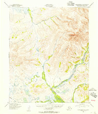
 1950 Mount Hayes1955 Print · USGSThe Alaska Interior in the early fifties shows a landscape of high peaks and essential roadhouse stops along the primitive highway system. Genealogists and historians can trace old travel routes and outposts like Rapids Roadhouse, Donnelly, and Paxson.2 unique versions available
 - 1950 Map of Bendeleben C-5, 1955 Print
 1950 Bendeleben C-51955 Print · USGSAlaska's Seward Peninsula is captured here in the mid-twentieth century as a landscape defined by mining-era drainages and early bush aviation. Researchers can trace remote transit routes along the Tractor Trail and locate sites like Noxapaga Airstrip (Abandoned) and Rainbow Camp Airstrip.3 unique versions available
 - 1950 Map of Nushagak Bay B-4, 1955 Print
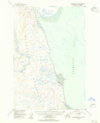
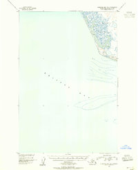 1950 Nushagak Bay B-41955 Print · USGSThe remote Alaskan coastline of the mid-century is captured here, showing the interaction of tide and tundra. Researchers can trace the shifting shoreline of the Nushagak Peninsula and the extensive Mud flats along Bristol Bay.2 unique versions available
 - 1950 Map of Bendeleben A-6, 1955 Print
 1950 Bendeleben A-61955 Print · USGSThe Seward Peninsula at mid-century reveals a landscape of industrial transition as old mining infrastructure began to fade. Researchers can trace the Seward Peninsula Railroad and locate vanished markers like Shelton and Pilgrim Springs.3 unique versions available
 - 1950 Map of Bendeleben B-5, 1955 Print
 1950 Bendeleben B-51955 Print · USGSThe Seward Peninsula wilderness in the 1950s is defined by the winding Kuzitrin River and the rising peaks of the Bendeleben Mountains. Trace a lonely Tractor Trail and explore remote drainages like Bonanza Creek and Mascot Creek.3 unique versions available
 - 1950 Map of Bendeleben A-4, 1955 Print
 1950 Bendeleben A-41955 Print · USGSThe Seward Peninsula interior at mid-century was a landscape of remote mining potential and intricate waterways. Trace the old Tractor Trail through the drainages of Ophir Creek and Goldbottom Creek to identify historical prospecting sites.2 unique versions available
 - 1950 Map of Bendeleben B-6, 1955 Print
 1950 Bendeleben B-61955 Print · USGSThe Kougarok River valley in 1950 was a hub of Alaskan gold mining and wilderness aviation. Researchers can trace the development of Placer Gold Mining Areas near Dahl, early landing strips, and the network of Tractor Trails connecting the remote interior.3 unique versions available
 - 1950 Map of Bendeleben B-2, 1955 Print
 1950 Bendeleben B-21955 Print · USGSThe Seward Peninsula interior at the mid-century is defined by the high peaks of the Bendeleben Mountains and the winding Koyuk River. Trace the river's path through the rapids and follow northern tributaries like Knowles Creek.3 unique versions available
 - 1950 Map of Bendeleben A-5, 1955 Print
 1950 Bendeleben A-51955 Print · USGSThe Seward Peninsula interior at mid-century is defined by the high peaks of the Bendeleben Mountains. Trace the complex drainages of the Niukluk River and Libby River along with remote landmarks like Mount Bendeleben.3 unique versions available
 - 1950 Map of Bendeleben A-3, 1955 Print
 1950 Bendeleben A-31955 Print · USGSThe Seward Peninsula interior at the midpoint of the century is a landscape of expansive marshes and seasonal routes. Trace the path of the Wagon Road and the Winter Trail as they navigate the drainages of Fish River and McCarthy Marsh.2 unique versions available
 - 1950 Map of Nushagak Bay C-3, 1955 Print
 1950 Nushagak Bay C-31955 Print · USGSThe eastern coast of the Nushagak Peninsula in the mid-twentieth century reveals a land of tidal rivers and shifting spits. Researchers can locate the historical Igushik (Site) and trace the coastal topography of Nichols Spit and the Nichols Hills.2 unique versions available
Showing maps 1-25 of 1,617
Top cities of Unorganized Borough
- Bethel historical maps
- Unalaska historical maps
- Valdez historical maps
- Nome historical maps
- Dillingham historical maps
- Cordova historical maps
See more
Frequently asked questions
- What are the different types of historical maps available for Unorganized Borough?
- What is the oldest map of Unorganized Borough?
- Where can I purchase historical maps of Unorganized Borough for my home or office?
- Where can I download high-res historical maps of Unorganized Borough?
- Are there historical topographic maps available for Unorganized Borough?
- Is there historical aerial imagery available for Unorganized Borough?
- Where are historical maps of Unorganized Borough sourced from?