1960s Maps of Unorganized Borough, Alaska
Explore 109 historic maps of Unorganized Borough from the 1960s. These maps offer a rare glimpse into what life looked like during the 1960s — showing old roads, neighborhoods, homes, and landmarks that have changed or disappeared over time.
Whether you're researching your family's past, planning a metal detecting trip, or studying how Unorganized Borough's landscape evolved across the 1960s, these high-resolution maps are a powerful tool for exploring the history of this region.
- Focus on a specific era: All maps on this page are from the 1960s, giving you a focused view of this time period.
- See what’s changed: Compare century-old streets, trails, and buildings to today's modern landscape using overlays and satellite layers.
- Research with precision: Use these maps for genealogy, historical research, land use analysis, or educational projects.
- View, download, or print: Maps are fully viewable online in high resolution, and can be downloaded or printed for your own records.
Start exploring Unorganized Borough's history through authentic maps from the 1960s. This is your window into the past.
Unorganized Borough, AK maps
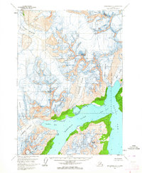
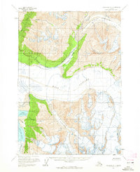
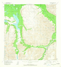
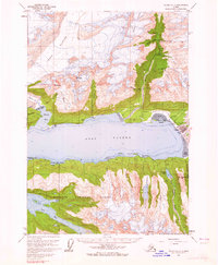
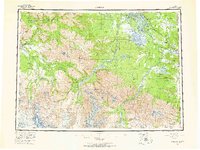
(109)- 1960 Map of Valdez A-8, 1963 Print
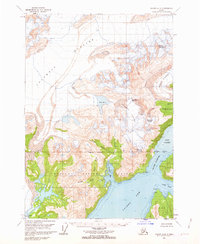 1960 Valdez A-81963 Print · USGSPrince William Sound at the start of the 1960s shows a landscape of massive ice fields and deep maritime inlets. Trace the glacial reaches of the Columbia Glacier and navigate coastal landmarks like Potato Pt and Middle Rock Light.3 unique versions available
 - 1960 Map of Anchorage A-2, 1963 Print
 1960 Anchorage A-21963 Print · USGSCoastal Alaska in the mid-century reveals a landscape of massive ice flows and deep inlets within the Chugach National Forest. Researchers can trace the reach of Yale Glacier and Meares Glacier or find local landmarks like Miners Lake and Unakwik Peak.2 unique versions available
 - 1960 Map of Anchorage A-1, 1963 Print
 1960 Anchorage A-11963 Print · USGSAlaskan wilderness meets the sea in the early 1960s, showing a landscape defined by massive ice fields and deep coastal bays. Researchers can trace the mid-century extent of the Columbia Glacier and locate landmarks like Billys Hole Lake and Columbia Peak.3 unique versions available
 - 1960 Map of Nabesna B-4, 1964 Print
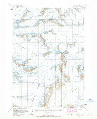
 1960 Nabesna B-41964 Print · USGSThe braided waters of the Nabesna River defined this Alaskan interior landscape in the early sixties. Trace a network of wilderness routes and remote outposts, from isolated Cabins near Jack Creek to the Tractor Trail and Reeve Field airstrip.3 unique versions available
 - 1960 Map of Anchorage A-4, 1964 Print
 1960 Anchorage A-41964 Print · USGSCoastal Alaska in the early sixties reveals a landscape of massive ice flows and deep saltwater inlets within the Chugach National Forest. Researchers can trace the mid-century extent of the Colony Glacier, Serpentine Glacier, and Surprise Glacier.3 unique versions available
 - 1960 Map of Valdez B-7, 1964 Print
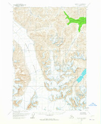
 1960 Valdez B-71964 Print · USGSThe high Chugach Mountains ice fields were meticulously documented in the 1960s, capturing the state of massive glaciers during a period of relative stability. Researchers and alpinists can trace the extent of the Columbia Glacier and Valdez Glacier or locate summits like Mount Logan.
 - 1960 Map of Anchorage A-3, 1964 Print
 1960 Anchorage A-31964 Print · USGSCoastal Alaska in the early sixties is defined here by the massive glaciers of the Chugach National Forest. Researchers can trace the ice lines of Bryn Mawr and Wellesley as they meet the waters of College Fiord.2 unique versions available
 - 1960 Map of Nabesna D-4, 1964 Print
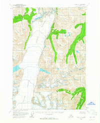
 1960 Nabesna D-41964 Print · USGSThe Alaska interior within the Tetlin Indian Reservation is captured here during the 1950s, showing a remote landscape defined by aviation and waterways. Researchers can trace the winding Tetlin River to the Landing Strip or locate high-altitude landmarks like Meiklejohn Pass.2 unique versions available
 - 1960 Map of Valdez C-7, 1965 Print
 1960 Valdez C-71965 Print · USGSAlaskan wilderness near the Copper River Meridian appears in this mid-century survey as a landscape of ice and high-altitude drainage. Researchers can trace the massive Tazlina Glacier and its relationship to Iceberg Lake and Klanelneechena Creek.2 unique versions available
 - 1960 Map of Anchorage B-4, 1965 Print
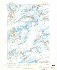
 1960 Anchorage B-41965 Print · USGSThe Knik River valley in the early 1960s was a remote expanse of active ice fields and mountain drainage. Researchers can trace the massive footprints of the Knik Glacier and Gannett Glacier or locate the isolated Landing Strip in Grasshopper Valley.3 unique versions available
 - 1960 Map of Anchorage B-1, 1965 Print
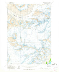
 1960 Anchorage B-11965 Print · USGSThe Chugach Mountains in the early 1960s reveal a landscape of immense ice fields and unnamed wilderness. Researchers can trace the massive flows of the Harvard Glacier and Yale Glacier or locate remote peaks like Mount Einstein and Mount Valhalla.2 unique versions available
 - 1960 Map of Anchorage B-3, 1965 Print
 1960 Anchorage B-31965 Print · USGSThe high peaks and massive ice fields of the Chugach Mountains appear here as they were mapped in the early sixties. Glacial researchers and mountain historians can trace the flow of the Knik Glacier or locate landmarks like Mount Marcus Baker and Mount Goode.3 unique versions available
 - 1960 Map of Anchorage B-2, 1965 Print
 1960 Anchorage B-21965 Print · USGSThe Chugach Mountains in the early sixties remain a world of ice and rock, centered on the massive Harvard Glacier. Researchers can trace the mid-century terminus of ice flows like Yale Glacier and the slopes of Mount Marcus Baker.2 unique versions available
 - 1960 Map of Nabesna B-5, 1965 Print
 1960 Nabesna B-51965 Print · USGSAlaska's high interior reaches come into focus in the late fifties, showcasing a rugged network of mining and hunting trails. Trace the early routes of the Tractor Trail to Tanada Lodge or locate the remote Mine near Gold Hill.3 unique versions available
 - 1960 Map of Valdez B-8, 1965 Print
 1960 Valdez B-81965 Print · USGSThe high Chugach peaks and massive ice fields of the early 1960s are documented in this detailed topographic study. Researchers can trace the massive flows of the Tazlina Glacier and Columbia Glacier, including hazardous crevasses and the Nelchina Glacier.2 unique versions available
 - 1960 Map of McCarthy D-8, 1965 Print
 1960 McCarthy D-81965 Print · USGSThe Alaskan wilderness near Scotty Peak is documented here in the early sixties, a time of expanding aerial surveys. Researchers can trace the path of the Kluvesna River and locate remote landmarks like Fall Creek and Surprise Creek.2 unique versions available
 - 1960 Map of Valdez C-8, 1965 Print
 1960 Valdez C-81965 Print · USGSNelchina Glacier and the surrounding high country are captured here in the early 1960s, showing the ice and peaks of the Copper River Meridian. Geologists and researchers can trace the movement of Nelchina Glacier and the drainages of Klanelneechena Creek.3 unique versions available
 - 1960 Map of Valdez A-7, 1965 Print
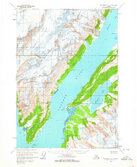
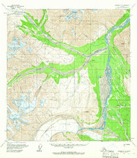
 1960 Valdez A-71965 Print · USGSThe port of Valdez and its surrounding mining districts are captured here in the early sixties, prior to the transformative 1964 earthquake. Researchers can trace the town's original layout, the Richardson Highway, and numerous lode sites like the Midas Mine and Cliff Mine.3 unique versions available
 - 1960 Map of Nabesna A-3, 1966 Print
 1960 Nabesna A-31966 Print · USGSThe remote interior of Alaska is captured here during the early sixties, centered on the glacial headwaters of the Nutzotin Mountains. Researchers can locate the Former Site of Chisana, the local Cem, and the Landing Strip serving this isolated river community.3 unique versions available
 - 1960 Map of Nabesna A-2, 1966 Print
 1960 Nabesna A-21966 Print · USGSSoutheast Fairbanks during the early 1960s was a landscape of remote mining outposts and glacial valleys. Researchers can trace the early trails and scattered settlements like Rhyolite, Bonanza, and Chathenda near the expansive Carl Glacier.2 unique versions available
 - 1960 Map of Nabesna B-2, 1966 Print
 1960 Nabesna B-21966 Print · USGSThe Chisana River valley in the early 1960s remains a wilderness defined by its braided waterways and seasonal routes. Researchers can locate the historic King City (Site) and trace the paths of the Winter Trail and Tractor Trail through the bush.2 unique versions available
 - 1960 Map of McCarthy D-6, 1966 Print
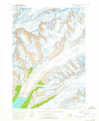
 1960 McCarthy D-61966 Print · USGSAlaska's high-altitude ice fields and mountain passes are captured here as they appeared in the early sixties. A researcher or mountaineer can trace the massive Nabesna Glacier and identify the specific corridor of Mountaineers Pass.
 - 1960 Map of Nabesna, 1966 Print
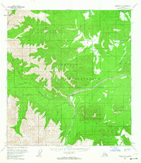
 1960 Nabesna1966 Print · USGSEastern Alaska's interior at the dawn of the sixties shows a landscape of remote indigenous villages and highway outposts. Genealogists and historians can locate Northway Indian Village, the Seaton Roadhouse, and mining history at Nabesna.5 unique versions available
 - 1960 Map of Nabesna C-4, 1966 Print
 1960 Nabesna C-41966 Print · USGSAlaska's interior wilderness comes into focus in the early sixties, showing a landscape defined by glacial rivers and northern trails. Trace early routes like the Pack Trail and Tractor Trail near the Nabesna River and Bean Lake.4 unique versions available
 - 1960 Map of Petersburg, 1966 Print
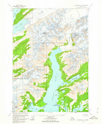
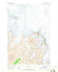
 1960 Petersburg1966 Print · USGSSoutheast Alaska's maritime landscape is captured here in the mid-1900s, showcasing the intricate island networks of the Alexander Archipelago. Researchers can trace historic shorelines and island settlements from Petersburg and Kake to the Wrangell Cemetery and the Stikine River.3 unique versions available
Showing maps 1-25 of 109
Top cities of Unorganized Borough
- Bethel historical maps
- Unalaska historical maps
- Valdez historical maps
- Nome historical maps
- Dillingham historical maps
- Cordova historical maps
See more
Frequently asked questions
- What are the different types of historical maps available for Unorganized Borough?
- What is the oldest map of Unorganized Borough?
- Where can I purchase historical maps of Unorganized Borough for my home or office?
- Where can I download high-res historical maps of Unorganized Borough?
- Are there historical topographic maps available for Unorganized Borough?
- Is there historical aerial imagery available for Unorganized Borough?
- Where are historical maps of Unorganized Borough sourced from?