
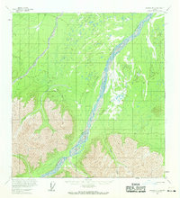
1960 Map of Nabesna B-2
USGS Topo · Published 1966About this map
The braided channels of the Chisana River dominate this 1960s landscape, illustrating a complex glacial drainage system in the Alaska interior. At the river's bend lies the King City (Site), a former settlement point that provides a vital reference for regional history. The map documents the primitive transportation network of the mid-twentieth century, including the Winter Trail and a Tractor Trail that navigate the lowlands and foothills. These routes, along with tributary drainages like Stuver Creek, Brian Creek, and Sheep Creek, highlight the era's reliance on seasonal and specialized paths for movement through the bush. Significant relief is noted at the Edge, where the terrain rises sharply from the river basin into more prominent highlands.
Find a feature on this map
9 named features on this map. Tap any name to fly to it.
Don’t see what you’re looking for? This feature index may not catch every label — zoom into the map to look around manually.
Map Details
Editions of this 1960 Nabesna B-2 Map
2 editions found
Other maps of this area

1950 · Nabesna
USGS Topo · 1:250,000

1951 · Nabesna
USGS Topo · 1:250,000

1954 · Nabesna C-3
USGS Topo · 1:63,360

1955 · Nabesna C-1
USGS Topo · 1:63,360

1955 · Nabesna C-2
USGS Topo · 1:63,360

1955 · Nabesna C-3
USGS Topo · 1:63,360

1959 · Nabesna A-1
USGS Topo · 1:63,360

1960 · Nabesna A-3
USGS Topo · 1:63,360

1960 · Nabesna A-2
USGS Topo · 1:63,360

1960 · Nabesna
USGS Topo · 1:250,000