
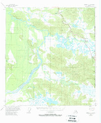
1955 Map of Nabesna C-1
USGS Topo · Published 1958About this map
The Alaska Highway cuts through the northeast corner of this territory in the mid-1950s, serving as a vital artery between the United States and Canada. This remote landscape is defined by the braided channels of the Chisana River and the extensive wetlands surrounding Scottie Creek. Small outposts like the Border City Trading Post and Scotty Creek Lodge mark the international boundary, providing essential services in the Interior. The map details early infrastructure including an aboveground Pipeline and a Telephone Line that run parallel to the highway. Terrain features like Airs Hill and the Black Hills rise above the complex network of lakes and marshes, such as Mirror Lake and Island Lake. Historical waypoints like the Seaton Roadhouse and High Cache further illustrate the early motorized travel and transport era in this subarctic region.
Find a feature on this map
18 named features on this map. Tap any name to fly to it.
Don’t see what you’re looking for? This feature index may not catch every label — zoom into the map to look around manually.
Map Details
Editions of this 1955 Nabesna C-1 Map
3 editions found
Other maps of this area

1950 · Nabesna
USGS Topo · 1:250,000

1951 · Nabesna
USGS Topo · 1:250,000

1952 · Nabesna D-1
USGS Topo · 1:63,360

1954 · Nabesna D-2
USGS Topo · 1:63,360

1955 · Nabesna C-2
USGS Topo · 1:63,360

1955 · Nabesna D-2
USGS Topo · 1:63,360

1960 · Nabesna B-2
USGS Topo · 1:63,360

1960 · Nabesna
USGS Topo · 1:250,000

1960 · Nabesna B-1
USGS Topo · 1:63,360
2013 · Nabesna D-1 SE
USGS Topo · 1:25,000