
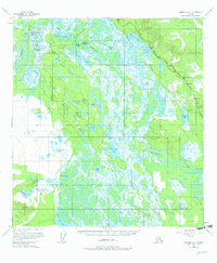
1955 Map of Nabesna D-2
USGS Topo · Published 1965About this map
Northway Indian Village and Nabesna Village anchor the northwestern portion of this 1950s interior landscape, situated where the Nabesna River winds through a vast network of wetlands and tundra. The region is defined by its water-logged terrain, featuring an immense concentration of named lakes such as Tontethaimund Lake, Dog Lake, and Tsolmund Lake. The settlement pattern reflects traditional native sites alongside mid-century infrastructure, including Kuthakne Village and Charlieskin Village, as well as the Airport and local Indian Cemetery.
Find a feature on this map
45 named features on this map. Tap any name to fly to it.
Don’t see what you’re looking for? This feature index may not catch every label — zoom into the map to look around manually.
Map Details
Editions of this 1955 Nabesna D-2 Map
2 editions found
Other maps of this area

1948 · Tanacross A-3
USGS Topo · 1:63,360

1949 · Tanacross
USGS Topo · 1:250,000

1950 · Tanacross
USGS Topo · 1:250,000

1950 · Nabesna
USGS Topo · 1:250,000

1951 · Nabesna
USGS Topo · 1:250,000

1952 · Tanacross A-3
USGS Topo · 1:63,360

1952 · Nabesna D-1
USGS Topo · 1:63,360

1952 · Tanacross A-1
USGS Topo · 1:63,360

1954 · Tanacross A-2
USGS Topo · 1:63,360

1954 · Nabesna D-2
USGS Topo · 1:63,360