
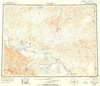
1950 Map of Tanacross
USGS Topo · Published 1950About this map
Tanacross and the surrounding wilderness of eastern Alaska were defined by early aviation and road-building during the mid-20th century. The intersection of the Alaska Highway and the Taylor Highway at Tok Junction reflects the post-war expansion of ground transport, while the Tanacross Airfield and the Mineral Springs Emergency Landing Field underscore the vital role of air travel in this remote interior.
Find a feature on this map
69 named features on this map. Tap any name to fly to it.
Don’t see what you’re looking for? This feature index may not catch every label — zoom into the map to look around manually.
Map Details
Editions of this 1950 Tanacross Map
2 editions found
Other maps of this area

1899 · Fortymile
USGS Topo · 1:250,000

1948 · Tanacross B-5
USGS Topo · 1:63,360

1948 · Tanacross A-6
USGS Topo · 1:63,360

1948 · Tanacross A-3
USGS Topo · 1:63,360

1948 · Tanacross A-4
USGS Topo · 1:63,360

1948 · Nabesna D-5
USGS Topo · 1:63,360

1948 · Tanacross A-5
USGS Topo · 1:63,360

1948 · Tanacross B-3
USGS Topo · 1:63,360

1949 · Tanacross
USGS Topo · 1:250,000

1949 · Tanacross B-4
USGS Topo · 1:63,360