
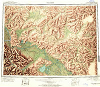
1949 Map of Tanacross
USGS Topo · Published 1958About this map
The Tanana River and its expansive floodplain anchor this mid-century look at the eastern Alaska interior. The landscape is defined by the intersection of traditional settlements and emerging cold-war era infrastructure, notably the Tanacross Airfield and the Mineral Point Emergency Landing Field. The Alaska Highway runs through the heart of the region, connecting critical outposts like Tok Junction and Tetlin Junction, while the older Eagle Trail provides a link to the historical overland travel routes of the territory's earlier days.
Find a feature on this map
77 named features on this map. Tap any name to fly to it.
Don’t see what you’re looking for? This feature index may not catch every label — zoom into the map to look around manually.
Map Details
Editions of this 1949 Tanacross Map
2 editions found
Other maps of this area

1899 · Fortymile
USGS Topo · 1:250,000

1948 · Tanacross B-5
USGS Topo · 1:63,360

1948 · Tanacross A-6
USGS Topo · 1:63,360

1948 · Tanacross A-3
USGS Topo · 1:63,360

1948 · Tanacross A-4
USGS Topo · 1:63,360

1948 · Nabesna D-5
USGS Topo · 1:63,360

1948 · Tanacross A-5
USGS Topo · 1:63,360

1948 · Tanacross B-3
USGS Topo · 1:63,360

1949 · Tanacross B-4
USGS Topo · 1:63,360

1949 · Nabesna D-6
USGS Topo · 1:63,360