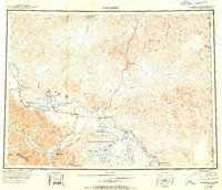
1950 Map of Tanacross
USGS Topo · Published 1950About this map
The Tanana River and the newly established Alaska Highway corridor dominate this mid-century reconnaissance of east-central Alaska. At a time when aviation and road access were fundamentally reshaping the interior, the map documents critical infrastructure like the Tanacross Airfield, Tetlin Landing Field, and the Mineral Point Emergency Landing Field. Older routes like the Eagle Trail and the Fortymile Highway intersect at Tok Junction, marking it as a rising transportation hub. Within the Tetlin Indian Reservation, the landscape is defined by the Tetlin Hills and the winding Tanana Slough. To the north and east, the map traces the international boundary between the Alaska Yukon and the United States Canada border, following remote drainages such as the Ladue River and the Sixtymile River. Traditional settlements like Mansfield Village and Tanacross remain focal points along the river's edge, contrasting with the official presence of the U S Customhouse.
Find a feature on this map
70 named features on this map. Tap any name to fly to it.
Don’t see what you’re looking for? This feature index may not catch every label — zoom into the map to look around manually.
Map Details
Editions of this 1950 Tanacross Map
2 editions found

Other maps of this area

1899 · Fortymile
USGS Topo · 1:250,000

1948 · Tanacross B-5
USGS Topo · 1:63,360

1948 · Tanacross A-6
USGS Topo · 1:63,360

1948 · Tanacross A-3
USGS Topo · 1:63,360

1948 · Tanacross A-4
USGS Topo · 1:63,360

1948 · Nabesna D-5
USGS Topo · 1:63,360

1948 · Tanacross A-5
USGS Topo · 1:63,360

1948 · Tanacross B-3
USGS Topo · 1:63,360

1949 · Tanacross
USGS Topo · 1:250,000

1949 · Tanacross B-4
USGS Topo · 1:63,360