
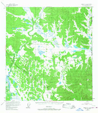
1952 Map of Nabesna D-1
USGS Topo · Published 1958About this map
The Alaska Highway cuts across this remote landscape in the interior of the Alaska-Yukon borderlands, serving as a primary corridor for mid-century infrastructure. During the early 1950s, this region supported essential transit and communication, evidenced by the Aboveground Pipeline and a Telephone Line following the highway’s path. The map provides a detailed view of these industrial landmarks alongside local outposts like the Gardiner Creek Camp and several small Cabins.
Find a feature on this map
17 named features on this map. Tap any name to fly to it.
Don’t see what you’re looking for? This feature index may not catch every label — zoom into the map to look around manually.
Map Details
Editions of this 1952 Nabesna D-1 Map
2 editions found
Other maps of this area

1949 · Tanacross
USGS Topo · 1:250,000

1950 · Tanacross
USGS Topo · 1:250,000

1950 · Nabesna
USGS Topo · 1:250,000

1951 · Nabesna
USGS Topo · 1:250,000

1952 · Tanacross A-1
USGS Topo · 1:63,360

1954 · Tanacross A-2
USGS Topo · 1:63,360

1954 · Nabesna D-2
USGS Topo · 1:63,360

1955 · Nabesna C-1
USGS Topo · 1:63,360

1955 · Nabesna C-2
USGS Topo · 1:63,360

1955 · Tanacross A-2
USGS Topo · 1:63,360