
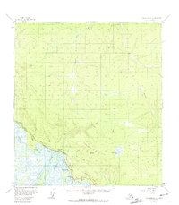
1955 Map of Tanacross A-2
USGS Topo · Published 1962About this map
The Alaska Highway corridor serves as the primary artery through this interior landscape, where the confluence of major glacial rivers dictates the pattern of mid-century human activity. Near the southern edge of the sheet, travelers in the mid-1950s encountered essential roadside stops like the Beaver Creek Roadhouse, Northway Junction, and the Northway Motel. These settlements supported traffic along the highway and an aboveground pipeline, while the surrounding terrain was defined by the complex aquatic network of the Tanana River, Chisana River, and Nabesna River. To the east, the landscape rises toward Cheneathda Hill, dotted with numerous water bodies such as Damundtali Lake, Shushamund Lake, and Thadthammund Lake, reflecting a region dominated by permafrost and seasonal drainage patterns typical of the Tanana Valley.
Find a feature on this map
19 named features on this map. Tap any name to fly to it.
Don’t see what you’re looking for? This feature index may not catch every label — zoom into the map to look around manually.
Map Details
Editions of this 1955 Tanacross A-2 Map
2 editions found
Other maps of this area

1948 · Tanacross A-3
USGS Topo · 1:63,360

1948 · Tanacross B-3
USGS Topo · 1:63,360

1949 · Tanacross
USGS Topo · 1:250,000

1949 · Tanacross B-3
USGS Topo · 1:63,360

1950 · Tanacross
USGS Topo · 1:250,000

1950 · Nabesna
USGS Topo · 1:250,000

1951 · Nabesna
USGS Topo · 1:250,000

1952 · Tanacross A-3
USGS Topo · 1:63,360

1952 · Tanacross B-3
USGS Topo · 1:63,360

1952 · Nabesna D-1
USGS Topo · 1:63,360