
1949 Map of Tanacross B-3
USGS Topo · Published 1965About this map
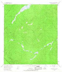
The Indian Reservation Boundary (Approximate) dominates the southern portion of this interior Alaskan landscape, marking a significant administrative division at the time of the 1948 aerial survey. The terrain is characterized by the winding course of Dennison Fork and the Ladue River, which carve through a series of prominent peaks and ridgelines. Early transportation routes are established here, with the Taylor Highway cutting across the northwest corner and the Alaska Highway visible in the southwest. A few isolated cabins represent the sparse human footprint in this wilderness. Geodetic markers such as VABM 3585 Denys and VABM 3822 Son indicate the high points utilized by surveyors to map this expansive territory shortly after the war, providing a baseline of the regional geography before later development.
Find a feature on this map
9 named features on this map. Tap any name to fly to it.
Don’t see what you’re looking for? This feature index may not catch every label — zoom into the map to look around manually.
Map Details
Editions of this 1949 Tanacross B-3 Map
2 editions found
Other maps of this area

1948 · Tanacross A-3
USGS Topo · 1:63,360

1948 · Tanacross A-4
USGS Topo · 1:63,360

1948 · Tanacross B-3
USGS Topo · 1:63,360

1949 · Tanacross
USGS Topo · 1:250,000

1949 · Tanacross B-4
USGS Topo · 1:63,360

1950 · Tanacross
USGS Topo · 1:250,000

1951 · Tanacross B-4
USGS Topo · 1:63,360

1952 · Tanacross A-4
USGS Topo · 1:63,360

1952 · Tanacross A-3
USGS Topo · 1:63,360

1952 · Tanacross B-3
USGS Topo · 1:63,360