
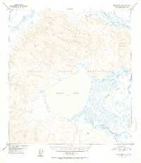
1952 Map of Tanacross A-4
USGS Topo · Published 1952About this map
The Tetlin Indian Reservation dominates this 1952 topographic study, centered on the expansive waters of Tetlin Lake. The landscape is defined by its complex hydrology, where the Tetlin River meanders through marshy lowlands and a series of smaller water bodies including the uniquely named Gasoline Lakes. To the north and east, the elevation rises sharply into the Tetlin Hills and toward Chisana Mountain, which stands at the eastern edge of the survey area.
Find a feature on this map
15 named features on this map. Tap any name to fly to it.
Don’t see what you’re looking for? This feature index may not catch every label — zoom into the map to look around manually.
Map Details
Editions of this 1952 Tanacross A-4 Map
2 editions found
Other maps of this area

1948 · Tanacross B-5
USGS Topo · 1:63,360

1948 · Tanacross A-3
USGS Topo · 1:63,360

1948 · Tanacross A-4
USGS Topo · 1:63,360

1948 · Nabesna D-5
USGS Topo · 1:63,360

1948 · Tanacross A-5
USGS Topo · 1:63,360

1948 · Tanacross B-3
USGS Topo · 1:63,360

1949 · Tanacross
USGS Topo · 1:250,000

1949 · Tanacross B-4
USGS Topo · 1:63,360

1949 · Tanacross A-5
USGS Topo · 1:63,360

1949 · Tanacross B-3
USGS Topo · 1:63,360