
1949 Map of Tanacross A-5
USGS Topo · Published 1965About this map
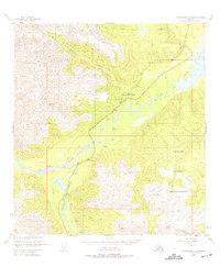
The confluence of the Tok River and the Little Tok River dominates this interior Alaskan landscape, which was mapped from 1948 aerial photography. The Tetlin Indian Reservation occupies a significant portion of the eastern quadrangle, marking the traditional lands of the Upper Tanana people. Transportation through this remote corridor is defined by the historic Eagle Trail and the developing Glenn Highway, which follows the river valleys. A remote aviation outpost is noted at the Mineral Point Landing Field, emphasizing the importance of bush flying for access. The map also records the Clearwater-Slana Campground and several high-altitude survey markers, such as VABM 5975 Meikle and VABM 5835 Rona, which guided the early photogrammetric mapping efforts in this unsurveyed territory of the Bureau of Land Management.
Find a feature on this map
12 named features on this map. Tap any name to fly to it.
Don’t see what you’re looking for? This feature index may not catch every label — zoom into the map to look around manually.
Map Details
Editions of this 1949 Tanacross A-5 Map
2 editions found
Other maps of this area

1948 · Tanacross B-5
USGS Topo · 1:63,360

1948 · Tanacross A-6
USGS Topo · 1:63,360

1948 · Tanacross A-4
USGS Topo · 1:63,360

1948 · Nabesna D-5
USGS Topo · 1:63,360

1948 · Tanacross A-5
USGS Topo · 1:63,360

1949 · Tanacross
USGS Topo · 1:250,000

1949 · Tanacross B-4
USGS Topo · 1:63,360

1949 · Nabesna D-6
USGS Topo · 1:63,360

1949 · Tanacross B-6
USGS Topo · 1:63,360

1950 · Tanacross
USGS Topo · 1:250,000