
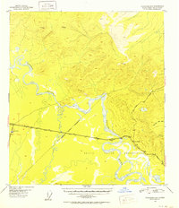
1951 Map of Tanacross B-4
USGS Topo · Published 1952About this map
The confluence of the Tanana River and Tok River anchors this postwar interior landscape, capturing a critical era of road development in eastern Alaska. The Alaska Highway serves as the primary east-west artery, intersecting with the Glenn Highway at Tok Junction and the Taylor Highway further east at Tetlin Junction. These junctions represent the transition from wartime military logistics to civilian connectivity, as the region became a gateway for travelers entering from Canada. South of the main road, the Tetlin Indian Reservation encompasses a vast lowland of braided streams and lakes, bounded by a surveyed Reservation Boundary. Survey markers such as VABM Tok and VABM Summit delineate the high ground overlooking the river valleys, while a Customhouse near the Tok hub highlights the town's role as a port of entry and administrative center.
Find a feature on this map
16 named features on this map. Tap any name to fly to it.
Don’t see what you’re looking for? This feature index may not catch every label — zoom into the map to look around manually.
Map Details
Editions of this 1951 Tanacross B-4 Map
2 editions found
Other maps of this area

1948 · Tanacross B-5
USGS Topo · 1:63,360

1948 · Tanacross A-3
USGS Topo · 1:63,360

1948 · Tanacross A-4
USGS Topo · 1:63,360

1948 · Tanacross A-5
USGS Topo · 1:63,360

1948 · Tanacross B-3
USGS Topo · 1:63,360

1949 · Tanacross
USGS Topo · 1:250,000

1949 · Tanacross B-4
USGS Topo · 1:63,360

1949 · Tanacross A-5
USGS Topo · 1:63,360

1949 · Tanacross B-3
USGS Topo · 1:63,360

1950 · Tanacross
USGS Topo · 1:250,000