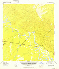
1951 Map of Tanacross B-4
USGS Topo · Published 1952About this map
The Tanana River winds through this Interior Alaska landscape during the early 1950s, a period defined by the critical expansion of the northern road system. The junction of the Alaska Highway and the Glenn Highway at Tok Junction serves as the primary regional hub, while the Taylor Highway branches off further east at Tetlin Junction. This survey captures the infrastructure of the post-war era, showing the path of a Pipe Line and the location of a Customhouse near the highway junction. South of the river, the Tetlin Indian Reservation encompasses the lower drainage basins, while the terrain to the north is marked by high survey points including Vabm Summit 3320 and Vabm Bush 3102. The mapping reflects a strategic transportation corridor where the heavy braided flow of the Tanana meets the primary overland routes connecting Alaska to the outside world.
Find a feature on this map
16 named features on this map. Tap any name to fly to it.
Don’t see what you’re looking for? This feature index may not catch every label — zoom into the map to look around manually.
Map Details
Editions of this 1951 Tanacross B-4 Map
2 editions found

Other maps of this area

1948 · Tanacross B-5
USGS Topo · 1:63,360

1948 · Tanacross A-3
USGS Topo · 1:63,360

1948 · Tanacross A-4
USGS Topo · 1:63,360

1948 · Tanacross A-5
USGS Topo · 1:63,360

1948 · Tanacross B-3
USGS Topo · 1:63,360

1949 · Tanacross
USGS Topo · 1:250,000

1949 · Tanacross B-4
USGS Topo · 1:63,360

1949 · Tanacross A-5
USGS Topo · 1:63,360

1949 · Tanacross B-3
USGS Topo · 1:63,360

1950 · Tanacross
USGS Topo · 1:250,000