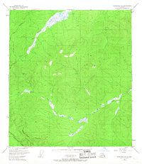
1949 Map of Tanacross B-3
USGS Topo · Published 1967About this map
The Tetlin Indian Reservation dominates the southwest corner of this subarctic landscape, bordered by the vital corridors of the Alaska Highway and Taylor Highway. Surveyed in the late 1940s, the terrain is defined by the winding course of the Dennison Fork and the Ladue River, where numerous wetlands and small lakes mark the valley floors. A single Cabin and a trans-regional Pipeline represent the sparse human footprint in an area otherwise characterized by high-elevation survey markers like Vabm 3822 Son. The infrastructure shown here reveals the post-war strategic importance of the region, emphasizing transportation and resource transit across the eastern Alaska interior near the Canadian border.
Find a feature on this map
10 named features on this map. Tap any name to fly to it.
Don’t see what you’re looking for? This feature index may not catch every label — zoom into the map to look around manually.
Map Details
Editions of this 1949 Tanacross B-3 Map
2 editions found
Other maps of this area

1948 · Tanacross A-3
USGS Topo · 1:63,360

1948 · Tanacross A-4
USGS Topo · 1:63,360

1948 · Tanacross B-3
USGS Topo · 1:63,360

1949 · Tanacross
USGS Topo · 1:250,000

1949 · Tanacross B-4
USGS Topo · 1:63,360

1949 · Tanacross B-3
USGS Topo · 1:63,360

1950 · Tanacross
USGS Topo · 1:250,000

1951 · Tanacross B-4
USGS Topo · 1:63,360

1952 · Tanacross A-4
USGS Topo · 1:63,360

1952 · Tanacross A-3
USGS Topo · 1:63,360