
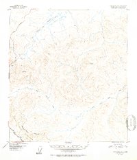
1952 Map of Tanacross B-3
USGS Topo · Published 1952About this map
Fortymile River headwaters dominate this 1952 topographic study, where the Dennison Fork meets the complex drainage systems of the eastern Alaska interior. The landscape is defined by the convergence of major travel corridors, including the intersection of the Alaska Highway and the Taylor Highway in the southwest corner. These routes provided essential access to the remote backcountry shortly after their construction, linking the region to both the Yukon and the interior.
Find a feature on this map
11 named features on this map. Tap any name to fly to it.
Don’t see what you’re looking for? This feature index may not catch every label — zoom into the map to look around manually.
Map Details
Editions of this 1952 Tanacross B-3 Map
2 editions found
Other maps of this area

1948 · Tanacross A-3
USGS Topo · 1:63,360

1948 · Tanacross A-4
USGS Topo · 1:63,360

1948 · Tanacross B-3
USGS Topo · 1:63,360

1949 · Tanacross
USGS Topo · 1:250,000

1949 · Tanacross B-4
USGS Topo · 1:63,360

1949 · Tanacross B-3
USGS Topo · 1:63,360

1950 · Tanacross
USGS Topo · 1:250,000

1951 · Tanacross B-4
USGS Topo · 1:63,360

1952 · Tanacross A-4
USGS Topo · 1:63,360

1952 · Tanacross A-3
USGS Topo · 1:63,360