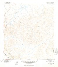
1952 Map of Tanacross B-3
USGS Topo · Published 1952About this map
The Tetlin Indian Reservation Boundary marks the southwestern corner of this 1952 topographic study, where the highland terrain begins its descent toward the river valleys. This interior Alaskan landscape is defined by the headwaters of two major drainage systems: the Dennison Fork Fortymile River in the north and the West Fork Ladue River winding through the southern half. These waterways serve as the primary geographical anchors in a region where human infrastructure was sparse in the early 1950s.
Find a feature on this map
10 named features on this map. Tap any name to fly to it.
Don’t see what you’re looking for? This feature index may not catch every label — zoom into the map to look around manually.
Map Details
Editions of this 1952 Tanacross B-3 Map
2 editions found

Other maps of this area

1948 · Tanacross A-3
USGS Topo · 1:63,360

1948 · Tanacross A-4
USGS Topo · 1:63,360

1948 · Tanacross B-3
USGS Topo · 1:63,360

1949 · Tanacross
USGS Topo · 1:250,000

1949 · Tanacross B-4
USGS Topo · 1:63,360

1949 · Tanacross B-3
USGS Topo · 1:63,360

1950 · Tanacross
USGS Topo · 1:250,000

1951 · Tanacross B-4
USGS Topo · 1:63,360

1952 · Tanacross A-4
USGS Topo · 1:63,360

1952 · Tanacross A-3
USGS Topo · 1:63,360