
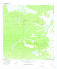
1960 Map of Nabesna B-1
USGS Topo · Published 1966About this map
Wellesley Mountain rises as a central landmark in this subarctic wilderness along the international boundary between Alaska and the Yukon Territory. The landscape is defined by an extensive system of drainages and wetlands, including the Wellesley Lakes and Stevens Lakes in the north, and Carden Lake situated near the Garden Hills to the south. The mapping reflects the mid-century topography of the United States and Canada border, a region largely inaccessible except by the seasonal Winter Trail shown winding through the southwestern quadrant. Dominant watercourses like Snag Creek and Carden Creek illustrate the complex hydrography of the interior, while the absence of permanent settlements underscores the isolation of the area during the 1950s aerial surveys.
Find a feature on this map
12 named features on this map. Tap any name to fly to it.
Don’t see what you’re looking for? This feature index may not catch every label — zoom into the map to look around manually.
Map Details
Editions of this 1960 Nabesna B-1 Map
2 editions found
Other maps of this area

1950 · Nabesna
USGS Topo · 1:250,000

1951 · Nabesna
USGS Topo · 1:250,000

1955 · Nabesna C-1
USGS Topo · 1:63,360

1955 · Nabesna C-2
USGS Topo · 1:63,360

1959 · Nabesna A-1
USGS Topo · 1:63,360

1960 · Nabesna A-2
USGS Topo · 1:63,360

1960 · Nabesna B-2
USGS Topo · 1:63,360

1960 · Nabesna
USGS Topo · 1:250,000
2016 · Nabesna A-2 NE
USGS Topo · 1:25,000
2016 · Nabesna B-2 NE
USGS Topo · 1:25,000