
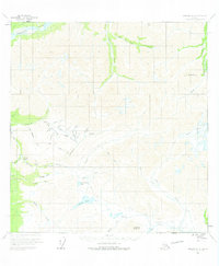
1960 Map of Nabesna A-2
USGS Topo · Published 1966About this map
Chisana River flows across the northern edge of this high-elevation terrain in the Alaska Interior, anchoring a landscape shaped by glacial activity and early 20th-century prospecting. Small settlements like Rhyolite, Bonanza, and Chathenda appear along the southwestern drainages, reflecting the region's mining heritage. The area is defined by sharp peaks and high passes, including Needle Peak and Caribou Pass, which separate the myriad creek systems such as Chavolda Creek and Beaver Creek. The presence of multiple glaciers, most notably Carl Glacier, indicates a land still heavily influenced by ice. Extensive tractor trails and pack trails trace the valleys, providing critical transit routes between remote outposts and water bodies like Little Beaver Lake. These networks reveal how early Alaskans navigated the challenging topography between the Gold Hill area and the broader drainage systems feeding into the Snag Creek basin.
Find a feature on this map
51 named features on this map. Tap any name to fly to it.
Don’t see what you’re looking for? This feature index may not catch every label — zoom into the map to look around manually.
Map Details
Editions of this 1960 Nabesna A-2 Map
2 editions found
Other maps of this area

1950 · Nabesna
USGS Topo · 1:250,000

1951 · McCarthy
USGS Topo · 1:250,000

1951 · Nabesna
USGS Topo · 1:250,000

1959 · McCarthy D-3
USGS Topo · 1:63,360

1959 · McCarthy D-2
USGS Topo · 1:63,360

1959 · Nabesna A-1
USGS Topo · 1:63,360

1960 · Nabesna A-3
USGS Topo · 1:63,360

1960 · Nabesna B-2
USGS Topo · 1:63,360

1960 · Nabesna
USGS Topo · 1:250,000

1960 · Nabesna B-3
USGS Topo · 1:63,360