
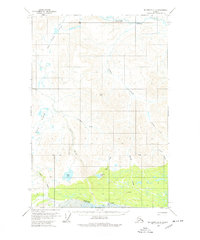
1959 Map of McCarthy D-2
USGS Topo · Published 1964About this map
White River drainage dominates the southern portion of this interior Alaskan landscape, where the glacial silt and braided river channels meet dense forest cover. To the north, the terrain transitions into a complex of high-elevation peaks and passes, including Fogenberg Pass and Black Hill. This 1950s survey captures a landscape primarily defined by its water systems, from the expansive Solo Flats and Solo Lake to the headwaters of Beaver Creek.
Find a feature on this map
19 named features on this map. Tap any name to fly to it.
Don’t see what you’re looking for? This feature index may not catch every label — zoom into the map to look around manually.
Map Details
Editions of this 1959 McCarthy D-2 Map
2 editions found
Other maps of this area

1950 · Nabesna
USGS Topo · 1:250,000

1951 · McCarthy
USGS Topo · 1:250,000

1951 · Nabesna
USGS Topo · 1:250,000

1959 · McCarthy D-1
USGS Topo · 1:63,360

1959 · McCarthy D-3
USGS Topo · 1:63,360

1959 · McCarthy C-3
USGS Topo · 1:63,360

1959 · Nabesna A-1
USGS Topo · 1:63,360

1959 · McCarthy C-1
USGS Topo · 1:63,360

1959 · McCarthy C-2
USGS Topo · 1:63,360

1960 · Nabesna A-2
USGS Topo · 1:63,360