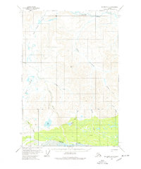
1959 Map of McCarthy D-2
USGS Topo · Published 1978About this map
White River flows across the southern edge of this Alaskan interior landscape, where human presence is marked by isolated Cabins and a Landing Strip near the riverbank. Surveyed in the late 1950s, the map documents a transition from the broad, wet lowlands of Solo Flats to the higher elevations of Black Hill and Burnt Hill. High-altitude routes are defined by Fogenberg Pass, which sits at the headwaters of Ophir Creek and Shotgold Creek. The drainage patterns are intricate, with several prominent water bodies including Solo Lake and Greene Lake situated in the central valley. This sheet captures a moment in the mid-20th century when access to this part of the Copper River Meridian relied heavily on small aircraft and remote river crossings, long before modern infrastructure reached these drainages.
Find a feature on this map
21 named features on this map. Tap any name to fly to it.
Don’t see what you’re looking for? This feature index may not catch every label — zoom into the map to look around manually.
Map Details
Editions of this 1959 McCarthy D-2 Map
2 editions found
Other maps of this area

1950 · Nabesna
USGS Topo · 1:250,000

1951 · McCarthy
USGS Topo · 1:250,000

1951 · Nabesna
USGS Topo · 1:250,000

1959 · McCarthy D-1
USGS Topo · 1:63,360

1959 · McCarthy D-3
USGS Topo · 1:63,360

1959 · McCarthy D-2
USGS Topo · 1:63,360

1959 · McCarthy C-3
USGS Topo · 1:63,360

1959 · Nabesna A-1
USGS Topo · 1:63,360

1959 · McCarthy C-1
USGS Topo · 1:63,360

1959 · McCarthy C-2
USGS Topo · 1:63,360