
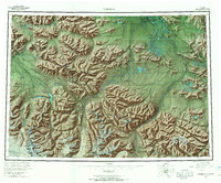
1960 Map of Nabesna
USGS Topo · Published 1966About this map
Northway Indian Village and several other indigenous settlements mark the confluence of the Nabesna River and Chisana River in this mid-century survey of eastern Alaska. The landscape is defined by the high elevations of the Wrangell Mountains and Mentasta Mountains, where landmarks like Tanada Peak and Mt Gordon rise above the complex river networks. Human activity is concentrated along the arterial Alaska Highway and Glenn Highway, connecting isolated locations such as Slana and the Seaton Roadhouse. The map documents the extensive Tetlin Indian Reservation and the mining-related geography near Nabesna at Gold Hill, while further east, Gardiner Creek Camp sits near the international border with the United States Canada boundary. Numerous remote water bodies, including Halthmund Lake and Tahamund Lake, dot the lowlands between the Black Hills and the winding river valleys.
Find a feature on this map
111 named features on this map. Tap any name to fly to it.
Don’t see what you’re looking for? This feature index may not catch every label — zoom into the map to look around manually.
Map Details
Editions of this 1960 Nabesna Map
5 editions found
Other maps of this area

1948 · Tanacross A-6
USGS Topo · 1:63,360

1948 · Tanacross A-3
USGS Topo · 1:63,360

1948 · Tanacross A-4
USGS Topo · 1:63,360

1948 · Nabesna C-6
USGS Topo · 1:63,360

1948 · Nabesna D-5
USGS Topo · 1:63,360

1948 · Tanacross A-5
USGS Topo · 1:63,360

1949 · Tanacross
USGS Topo · 1:250,000

1949 · Nabesna D-6
USGS Topo · 1:63,360

1949 · Tanacross A-5
USGS Topo · 1:63,360

1949 · Gulkana C-1
USGS Topo · 1:63,360