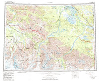
1960 Map of Nabesna
USGS Topo · Published 1987About this map
Northway and its surrounding village network sit at the confluence of the Tetlin River and Nabesna River, serving as a vital interior hub near the Alaska Yukon border. This region, surveyed between 1948 and 1960, illustrates a landscape where traditional indigenous sites like Nabesna Village and Batzulnetas coexist with early twentieth-century mining legacies. To the south, the Nutzotin Mountains and the massive Wrangell Mountains dominate the terrain, with the Nabesna Glacier and Chisana Glacier carving deep valleys through the high country. The map traces the essential transport corridors of the era, including the Glenn Highway and the Nabesna Road, which provided the only vehicular access to remote settlements like Nabesna. Remote outposts such as Chisana and the Gold Hill mining area highlight the persistent search for minerals in the copper and gold belts of the Wrangell-St Elias wilderness.
Find a feature on this map
73 named features on this map. Tap any name to fly to it.
Don’t see what you’re looking for? This feature index may not catch every label — zoom into the map to look around manually.
Map Details
Editions of this 1960 Nabesna Map
5 editions found

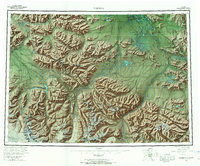
Other maps of this area

1948 · Tanacross A-6
USGS Topo · 1:63,360

1948 · Tanacross A-3
USGS Topo · 1:63,360

1948 · Tanacross A-4
USGS Topo · 1:63,360

1948 · Nabesna C-6
USGS Topo · 1:63,360

1948 · Nabesna D-5
USGS Topo · 1:63,360

1948 · Tanacross A-5
USGS Topo · 1:63,360

1949 · Tanacross
USGS Topo · 1:250,000

1949 · Nabesna D-6
USGS Topo · 1:63,360

1949 · Tanacross A-5
USGS Topo · 1:63,360

1949 · Gulkana C-1
USGS Topo · 1:63,360