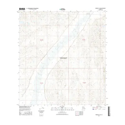
2016 Map of Nabesna B-2 NE
USGS Topo · Published 2016About this map
Wrangell-Saint Elias National Preserve encompasses the vast majority of this landscape, situated in the interior of Alaska's unorganized borough. The terrain is defined by the shifting course of the Chisana River, which weaves through a broad, braided valley system that dominates the central and eastern portions of the map. This river system, along with smaller tributaries like Edge Cr and Beaver Cr, represents a pristine wilderness environment where drainage patterns and topographic relief are the primary markers of the land. Mapping here reveals the intricate braided channels and sandbars of the river, illustrating the dynamic nature of Alaskan glacial-fed waterways in a region largely untouched by permanent settlement or infrastructure. The land is subdivided by township and range lines including t8n r21e and t7n r20e, which provide the only formal grid across the preservation lands.
Find a feature on this map
8 named features on this map. Tap any name to fly to it.
Don’t see what you’re looking for? This feature index may not catch every label — zoom into the map to look around manually.
Map Details
Editions of this 2016 Nabesna B-2 NE Map
This is the sole edition of this map. No revisions or reprints were ever made.
Other maps of this area

1950 · Nabesna
USGS Topo · 1:250,000

1951 · Nabesna
USGS Topo · 1:250,000

1955 · Nabesna C-1
USGS Topo · 1:63,360

1955 · Nabesna C-2
USGS Topo · 1:63,360

1960 · Nabesna B-2
USGS Topo · 1:63,360

1960 · Nabesna
USGS Topo · 1:250,000

1960 · Nabesna B-1
USGS Topo · 1:63,360
2016 · Nabesna C-2 SE
USGS Topo · 1:25,000
2016 · Nabesna C-1 SW
USGS Topo · 1:25,000
2016 · Nabesna C-2 SW
USGS Topo · 1:25,000