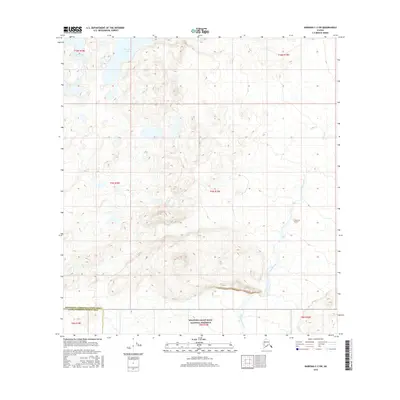
2016 Map of Nabesna C-2 SW
USGS Topo · Published 2016About this map
Wrangell-Saint Elias National Preserve occupies the southern reaches of this landscape, where the high subarctic terrain begins its transition into one of the nation's largest protected wilderness areas. The map reveals a high-elevation environment dominated by the drainage system of Stuver Creek, which flows through several townships including t9n r19e. In the northern section, Takomahlo Lake stands as a primary water body amid a complex network of topographical contours. The boundary between the Southeast Fairbanks Census Area and the Valdez-Cordova Census Area cuts across the southern portion of the sheet, providing a precise record of administrative jurisdictions in this part of the Alaska interior during the mid-2010s.
Find a feature on this map
11 named features on this map. Tap any name to fly to it.
Don’t see what you’re looking for? This feature index may not catch every label — zoom into the map to look around manually.
Map Details
Editions of this 2016 Nabesna C-2 SW Map
This is the sole edition of this map. No revisions or reprints were ever made.
Other maps of this area

1950 · Nabesna
USGS Topo · 1:250,000

1951 · Nabesna
USGS Topo · 1:250,000

1954 · Nabesna C-3
USGS Topo · 1:63,360

1955 · Nabesna C-2
USGS Topo · 1:63,360

1955 · Nabesna C-3
USGS Topo · 1:63,360

1960 · Nabesna B-2
USGS Topo · 1:63,360

1960 · Nabesna
USGS Topo · 1:250,000

1960 · Nabesna B-3
USGS Topo · 1:63,360
2016 · Nabesna C-2 NE
USGS Topo · 1:25,000
2016 · Nabesna B-2 NE
USGS Topo · 1:25,000