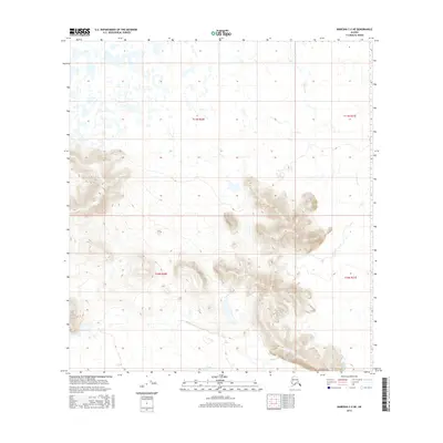
2016 Map of Nabesna C-2 NE
USGS Topo · Published 2016About this map
Stuver Cr flows through the northern reaches of this Alaskan interior landscape, where glacial terrain and seasonal wetlands dominate the high-latitude environment. The topographical survey highlights a transition from the lower, wetland-rich basins to the south-central highlands where elevations rise significantly. This area, delineated by the Public Land Survey System into t11n r20e, t11n r21e, t10n r20e, and t10n r21e, remains primarily a wilderness of unorganized territory. The map is particularly useful for visualizing the natural drainage patterns of the Stuver Creek watershed and the intricate contour intervals that define the steep, unnamed ridges across the southern half of the quadrangle.
Find a feature on this map
5 named features on this map. Tap any name to fly to it.
Don’t see what you’re looking for? This feature index may not catch every label — zoom into the map to look around manually.
Map Details
Editions of this 2016 Nabesna C-2 NE Map
This is the sole edition of this map. No revisions or reprints were ever made.
Other maps of this area

1950 · Nabesna
USGS Topo · 1:250,000

1951 · Nabesna
USGS Topo · 1:250,000

1952 · Nabesna D-1
USGS Topo · 1:63,360

1954 · Nabesna D-2
USGS Topo · 1:63,360

1955 · Nabesna C-1
USGS Topo · 1:63,360

1955 · Nabesna C-2
USGS Topo · 1:63,360

1955 · Nabesna D-2
USGS Topo · 1:63,360

1960 · Nabesna
USGS Topo · 1:250,000
2016 · Nabesna C-1 NW
USGS Topo · 1:25,000
2016 · Nabesna C-2 SE
USGS Topo · 1:25,000