
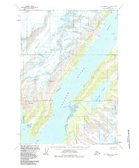
1960 Map of Anchorage A-3
USGS Topo · Published 1964About this map
College Fiord serves as the central focal point of this coastal Alaskan landscape, where massive ice fields meet the sea within the Chugach National Forest. The map documents a remarkable concentration of tidewater and hanging glaciers, many named for Ivy League and prominent women's colleges, including the Bryn Mawr, Wellesley, Smith, and Vassar. These ice flows descend from high peaks like Mt Emerson and Mt Coville, terminating at the water's edge of the Harvard Arm and Yale Arm.
Find a feature on this map
33 named features on this map. Tap any name to fly to it.
Don’t see what you’re looking for? This feature index may not catch every label — zoom into the map to look around manually.
Map Details
Editions of this 1960 Anchorage A-3 Map
2 editions found
Other maps of this area

1951 · Seward
USGS Topo · 1:250,000

1951 · Anchorage
USGS Topo · 1:250,000

1951 · Seward D-2
USGS Topo · 1:63,360

1951 · Seward D-4
USGS Topo · 1:63,360

1951 · Seward D-3
USGS Topo · 1:63,360

1952 · Seward D-3
USGS Topo · 1:63,360

1952 · Seward D-4
USGS Topo · 1:63,360

1952 · Seward D-2
USGS Topo · 1:63,360

1953 · Seward
USGS Topo · 1:250,000

1959 · Seward
USGS Topo · 1:250,000