
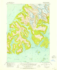
1952 Map of Seward D-3
USGS Topo · Published 1954About this map
Esther Island and its surrounding glacial waterways dominate this mid-century coastal survey within the Chugach National Forest. The transition of human activity in this maritime landscape is marked by the settlement at Golden (Aban'd) on Port Wells, contrasted with functional aids to navigation like the Esther Island Light and the CAA Radio Range Sta on the Dutch Group islands. The complex shoreline is carved by deep inlets such as Derickson Bay and Eaglek Bay, where massive ice flows like the Crescent Glacier and Eaglek Glacier meet the sea. Inland, the interior of the island is defined by the significant Esther Lake, which drains via Lake Bay into the surrounding sounds. This map provides a detailed view of the sound’s hydrography and topography before significant modern changes, documenting the location of remote cabins and family-named landmarks like Bald Head Chris I.
Find a feature on this map
35 named features on this map. Tap any name to fly to it.
Don’t see what you’re looking for? This feature index may not catch every label — zoom into the map to look around manually.
Map Details
Editions of this 1952 Seward D-3 Map
2 editions found
Other maps of this area

1951 · Seward
USGS Topo · 1:250,000

1951 · Anchorage
USGS Topo · 1:250,000

1951 · Seward D-2
USGS Topo · 1:63,360

1951 · Seward D-4
USGS Topo · 1:63,360

1951 · Seward D-3
USGS Topo · 1:63,360

1951 · Seward C-4
USGS Topo · 1:63,360

1951 · Seward C-3
USGS Topo · 1:63,360

1951 · Seward C-2
USGS Topo · 1:63,360

1952 · Seward C-3
USGS Topo · 1:63,360

1952 · Seward C-2
USGS Topo · 1:63,360