
1951 Map of Seward C-3
USGS Topo · Published 1967About this map
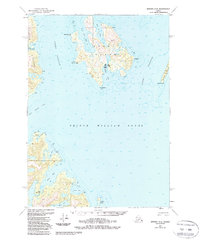
Perry Island and Culross Island dominate this coastal survey of northwestern Prince William Sound, where deep glacial waters meet a complex shoreline of bays and passages. The maritime character of the early 1950s is evident in the presence of several cabins and a light station, signaling the area's importance for local navigation and seasonal use. While the islands are largely uninhabited by major settlements, the map documents the Lighthouse Reserve on the mainland and the strategic positioning of landmarks like Meares Pt and Billings Pt.
Find a feature on this map
26 named features on this map. Tap any name to fly to it.
Don’t see what you’re looking for? This feature index may not catch every label — zoom into the map to look around manually.
Map Details
Editions of this 1951 Seward C-3 Map
2 editions found
Other maps of this area

1950 · Seward B-3
USGS Topo · 1:63,360

1951 · Seward
USGS Topo · 1:250,000

1951 · Seward B-4
USGS Topo · 1:63,360

1951 · Seward D-2
USGS Topo · 1:63,360

1951 · Seward D-4
USGS Topo · 1:63,360

1951 · Seward B-2
USGS Topo · 1:63,360

1951 · Seward D-3
USGS Topo · 1:63,360

1951 · Seward C-4
USGS Topo · 1:63,360

1951 · Seward C-2
USGS Topo · 1:63,360

1952 · Seward B-4
USGS Topo · 1:63,360