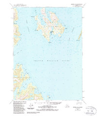
1951 Map of Seward C-3
USGS Topo · Published 1988About this map
Prince William Sound dominates this mid-century maritime study, centering on the intricate coastlines of Perry Island and Culross Island. This 1951 edition, updated with 1980s data, illustrates the navigational infrastructure of the region, specifically marking a Seaplane Base on the southern shore of Perry Island and a designated Lighthouse Reserve to the west. The map captures the specialized economy of the Alaskan coast, including a Fish Hatchery situated near Main Bay.
Find a feature on this map
29 named features on this map. Tap any name to fly to it.
Don’t see what you’re looking for? This feature index may not catch every label — zoom into the map to look around manually.
Map Details
Editions of this 1951 Seward C-3 Map
2 editions found
Other maps of this area

1950 · Seward B-3
USGS Topo · 1:63,360

1951 · Seward
USGS Topo · 1:250,000

1951 · Seward B-4
USGS Topo · 1:63,360

1951 · Seward D-2
USGS Topo · 1:63,360

1951 · Seward D-4
USGS Topo · 1:63,360

1951 · Seward B-2
USGS Topo · 1:63,360

1951 · Seward D-3
USGS Topo · 1:63,360

1951 · Seward C-4
USGS Topo · 1:63,360

1951 · Seward C-3
USGS Topo · 1:63,360

1951 · Seward C-2
USGS Topo · 1:63,360