
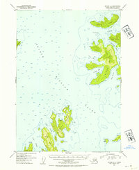
1952 Map of Seward C-2
USGS Topo · Published 1954About this map
Naked Island and its surrounding archipelago dominate this mid-century hydrographic survey of the central Prince William Sound. The map reveals a cluster of isolated dwellings, marked simply as Cabin or Cabins, scattered across Storey Island, Peak Island, and Eleanor Island. These small structures, often situated near protected waters like Cabin Bay or Bass Harbor, suggest a remote lifestyle tied to the sea before the era of modern development.
Find a feature on this map
44 named features on this map. Tap any name to fly to it.
Don’t see what you’re looking for? This feature index may not catch every label — zoom into the map to look around manually.
Map Details
Editions of this 1952 Seward C-2 Map
2 editions found
Other maps of this area

1950 · Seward B-3
USGS Topo · 1:63,360

1951 · Seward
USGS Topo · 1:250,000

1951 · Seward B-1
USGS Topo · 1:63,360

1951 · Seward D-2
USGS Topo · 1:63,360

1951 · Seward D-1
USGS Topo · 1:63,360

1951 · Seward B-2
USGS Topo · 1:63,360

1951 · Seward D-3
USGS Topo · 1:63,360

1951 · Seward C-1
USGS Topo · 1:63,360

1951 · Seward C-3
USGS Topo · 1:63,360

1951 · Seward C-2
USGS Topo · 1:63,360