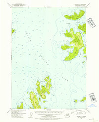
1952 Map of Seward C-2
USGS Topo · Published 1954About this map
Prince William Sound dominates this mid-century maritime study, centering on a cluster of rugged islands including the large, irregular landmass of Naked Island. The terrain is defined by deep bays and intricate waterways, notably Cabin Bay and Outside Bay on the west, and Bass Harbor to the south. Small clusters of Cabins are noted on several islands, such as Storey Island and Eleanor Island, hinting at the seasonal use of these remote outposts by fishermen or trappers.
Find a feature on this map
43 named features on this map. Tap any name to fly to it.
Don’t see what you’re looking for? This feature index may not catch every label — zoom into the map to look around manually.
Map Details
Editions of this 1952 Seward C-2 Map
2 editions found

Other maps of this area

1950 · Seward B-3
USGS Topo · 1:63,360

1951 · Seward
USGS Topo · 1:250,000

1951 · Seward B-1
USGS Topo · 1:63,360

1951 · Seward D-2
USGS Topo · 1:63,360

1951 · Seward D-1
USGS Topo · 1:63,360

1951 · Seward B-2
USGS Topo · 1:63,360

1951 · Seward D-3
USGS Topo · 1:63,360

1951 · Seward C-1
USGS Topo · 1:63,360

1951 · Seward C-3
USGS Topo · 1:63,360

1951 · Seward C-2
USGS Topo · 1:63,360