
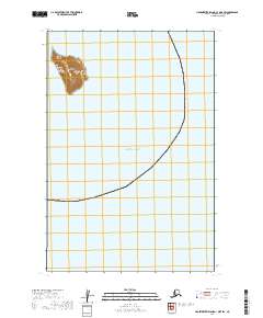
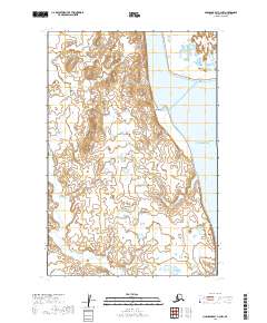
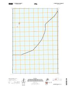
1948 Map of Nushagak Bay D-4
USGS Topo · Published 1975About this map
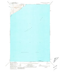
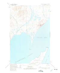
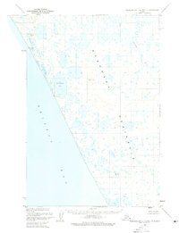
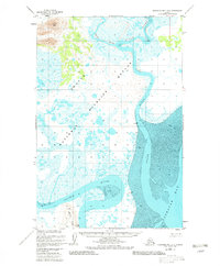
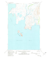
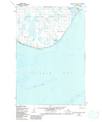
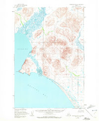
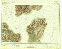
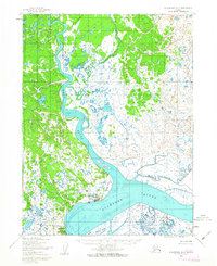
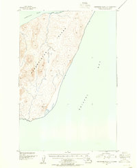
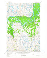
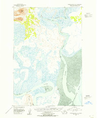
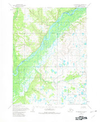
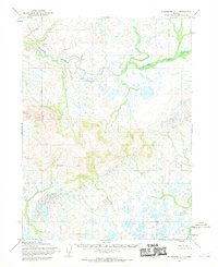
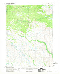
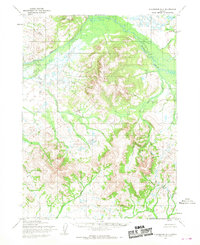
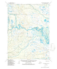
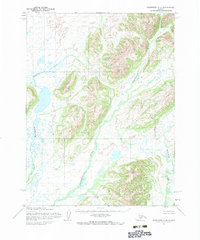
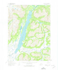
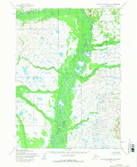
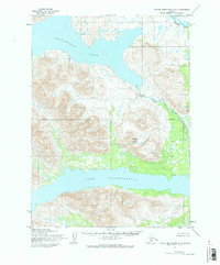
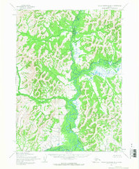
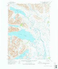
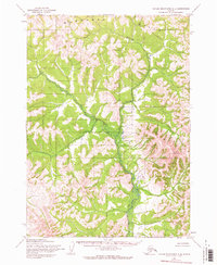
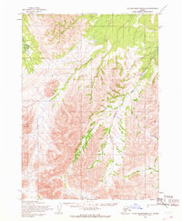
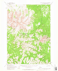
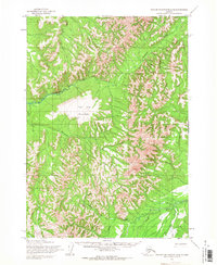
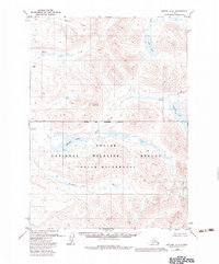
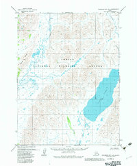
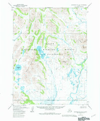
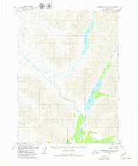
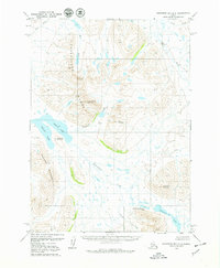
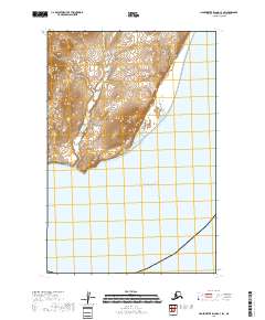
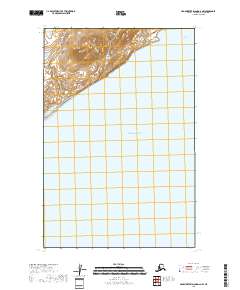
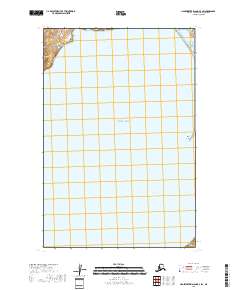
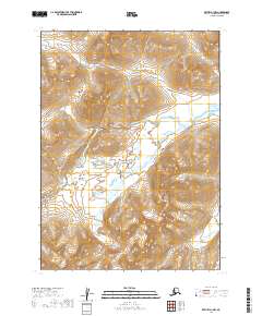
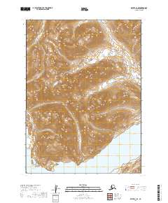
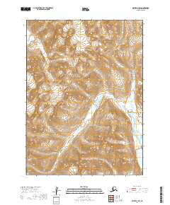
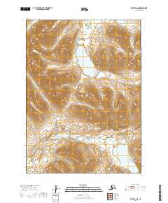
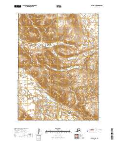
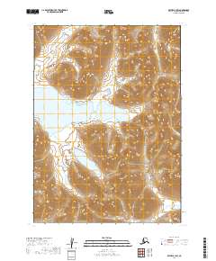
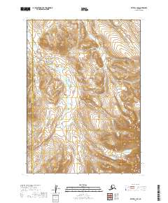
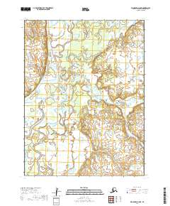
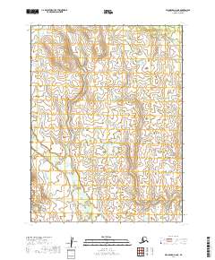
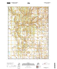
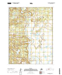
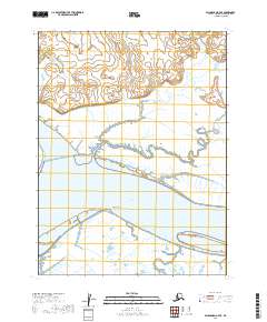
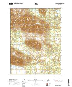
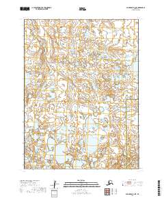
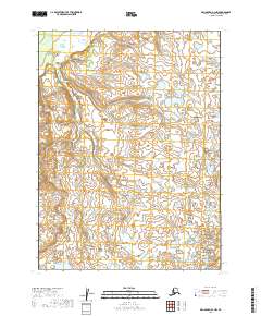
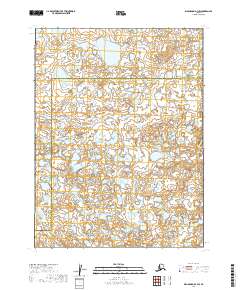
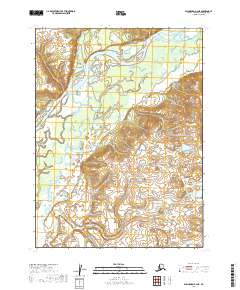
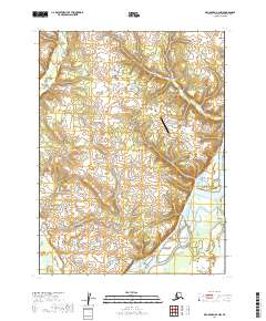
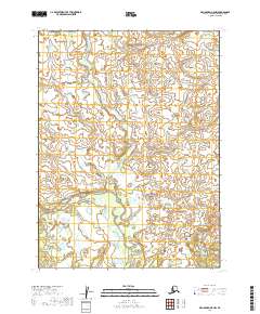
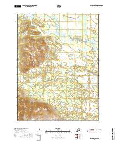
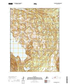
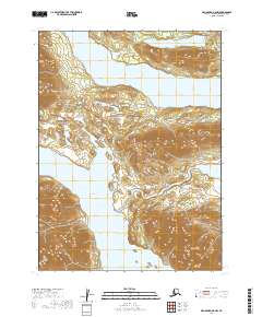
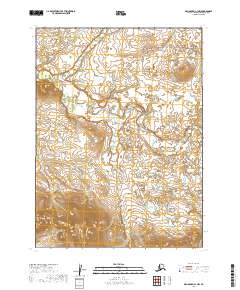
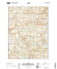
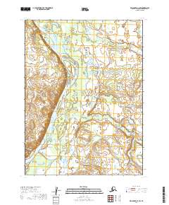
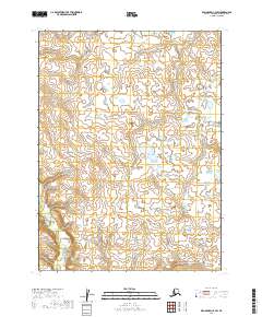
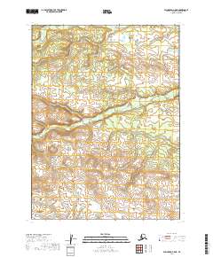
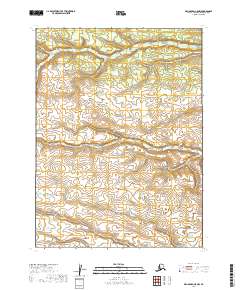
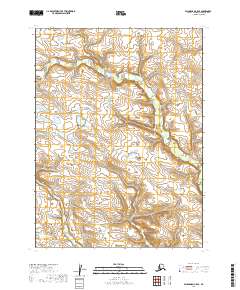
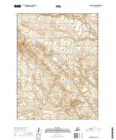
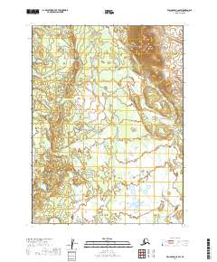
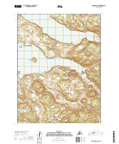
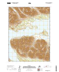
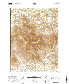
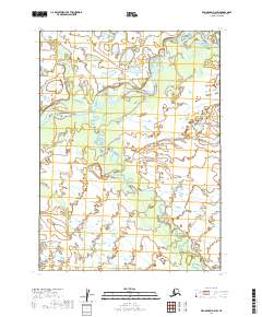
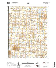
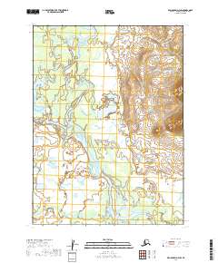
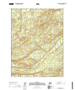
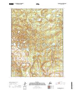
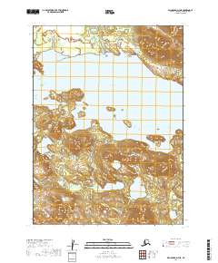
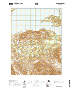
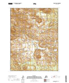
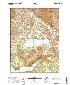
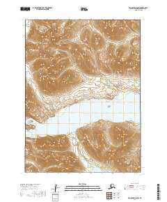
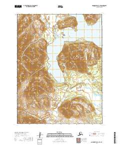
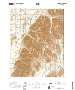
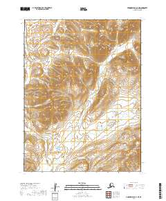
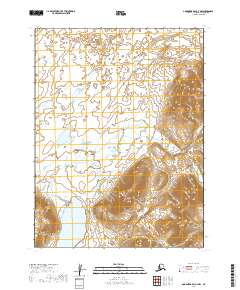
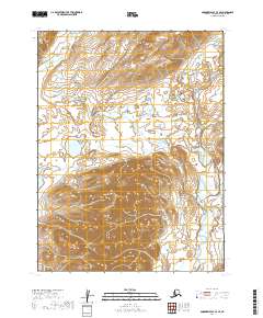
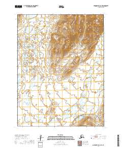
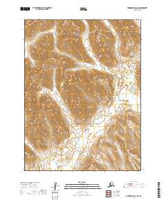
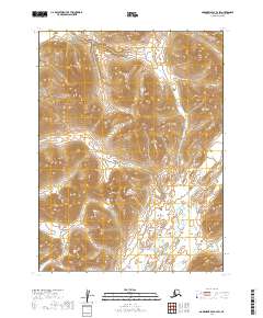
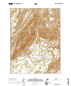
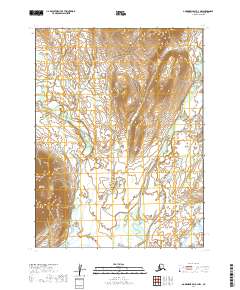
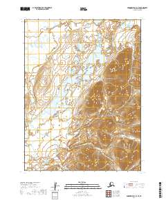
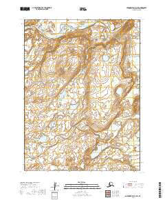
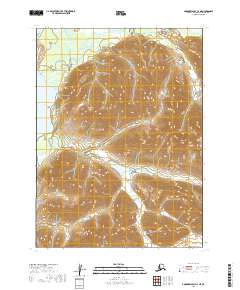
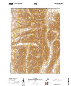
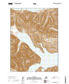
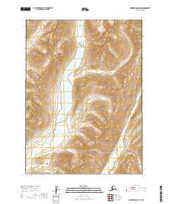
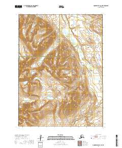
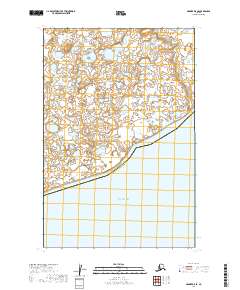
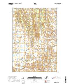
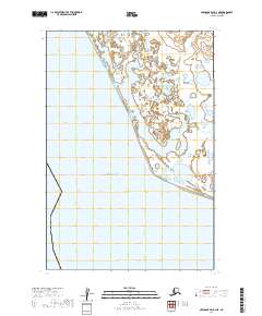
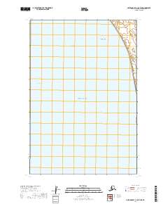
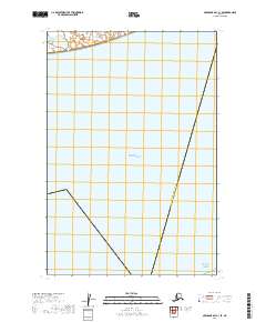
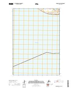
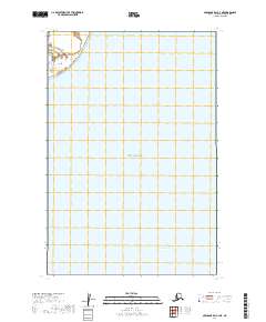
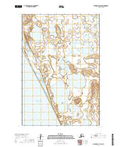
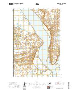
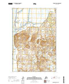
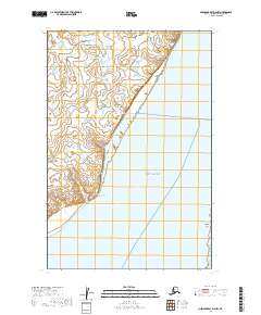
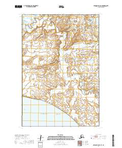
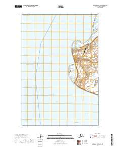
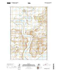
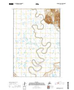
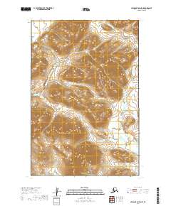
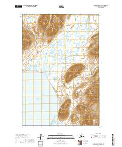
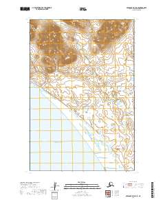
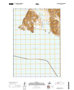
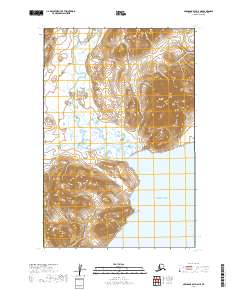
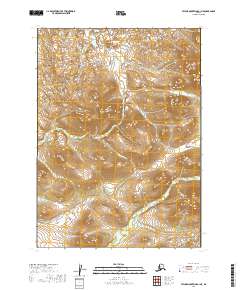
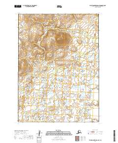
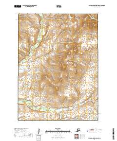
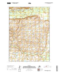
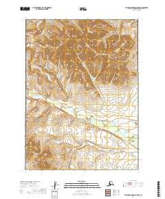
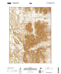
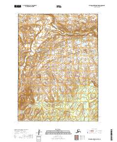
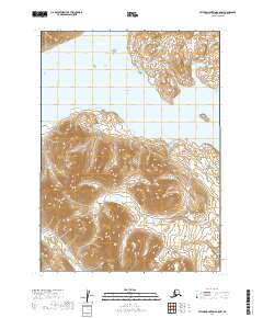
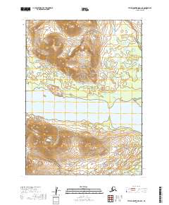
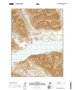
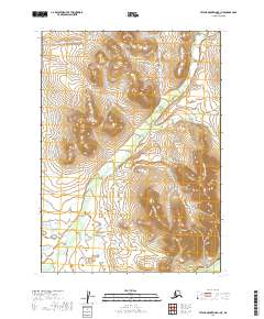
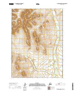
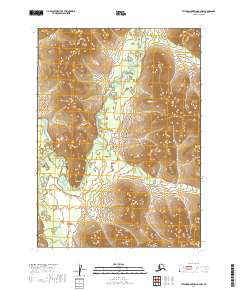
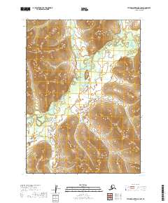
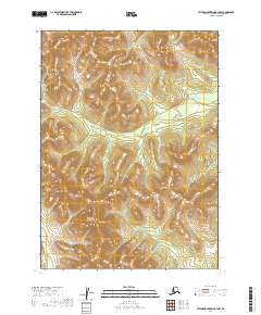
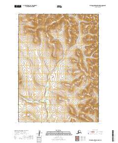
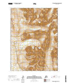
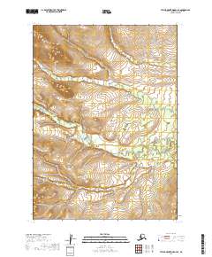
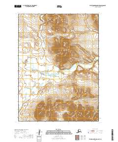
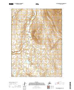
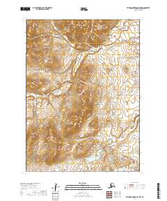
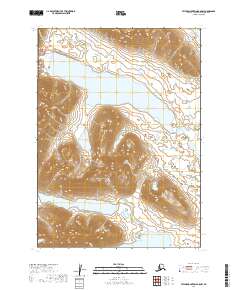
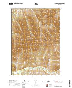
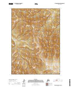
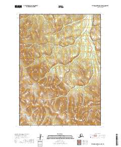
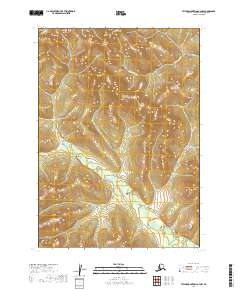
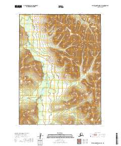
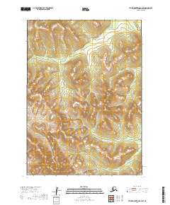
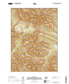
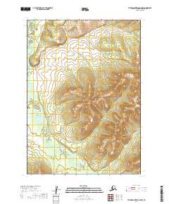
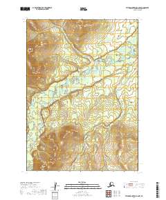
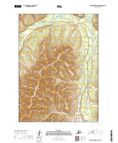
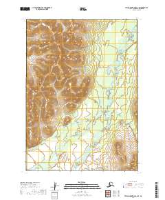
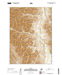
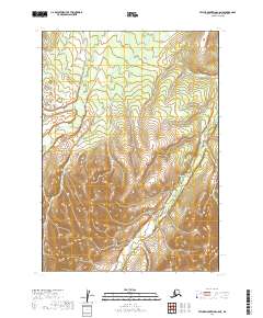
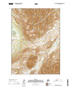
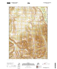
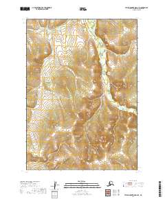
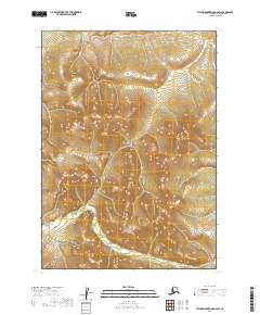
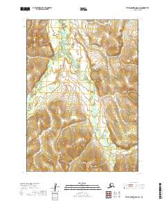
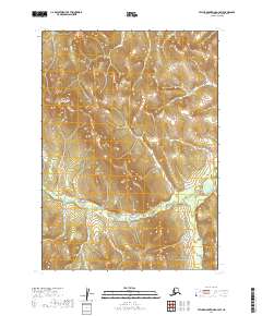
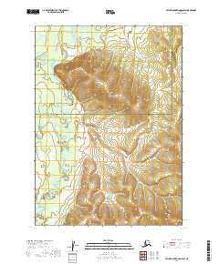
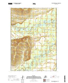
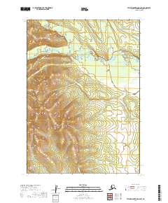
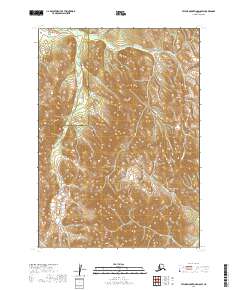
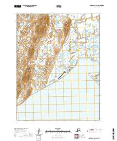
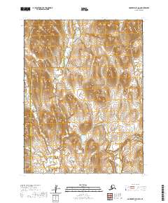
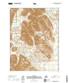
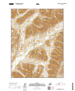
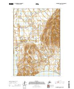
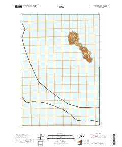
The Igushik River dominates this 1948 landscape, winding in tight, complex oxbows through a vast wetland of swamps and ponds. Surveyed from aerial photographs by the U.S. Coast and Geodetic Survey, the map captures the remote character of the Bristol Bay region during the late 1940s. The village of Manokotak is situated in the northeastern corner at the base of the upland terrain, while the settlement of Tuklung sits further south along the Tuklung River. A solitary Landing Strip near Tuklung highlights the critical role of aviation in connecting these isolated coastal communities. To the east, the Tunuing River flows into the larger river system, illustrating the intricate drainage patterns that define this part of the Alaska Peninsula.
Find a feature on this map
6 named features on this map. Tap any name to fly to it.
Don’t see what you’re looking for? This feature index may not catch every label — zoom into the map to look around manually.
Map Details
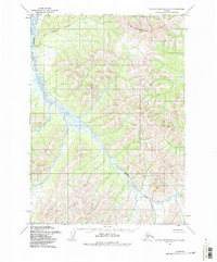
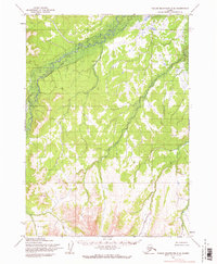
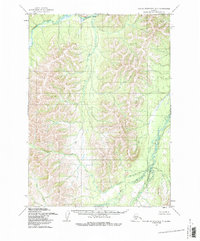
Editions of this 1948 Nushagak Bay D-4 Map
This is the sole edition of this map. No revisions or reprints were ever made.
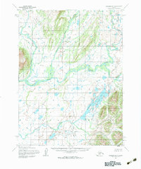
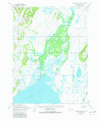
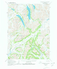
Historical Maps of Manokotak Through Time
487 maps found
1947 Hagemeister Island D-2
Dillingham Borough, AK

1948 Hagemeister Island C-1
Dillingham Borough, AK
1948 Hagemeister Island C-2
Dillingham Borough, AK
1948 Hagemeister Island C-3
Dillingham Borough, AK
1948 Hagemeister Island C-4
Dillingham Borough, AK
1948 Hagemeister Island D-3
Dillingham Borough, AK
1948 Nushagak Bay C-4 And C-5
Dillingham Borough, AK
1948 Nushagak Bay D-3
Dillingham Borough, AK
1948 Nushagak Bay D-4
Dillingham Borough, AK
1950 Hagemeister Island D-1
Dillingham Borough, AK
1950 Nushagak Bay B-3
Dillingham Borough, AK
1950 Nushagak Bay B-4
Dillingham Borough, AK
1950 Nushagak Bay C-3
Dillingham Borough, AK
1950 Nushagak Bay C-4 And C-5
Dillingham Borough, AK
1950 Nushagak Bay D-5
Dillingham Borough, AK
1950 Nushagak Bay D-6
Dillingham Borough, AK

1950 Taylor Mountains
Dillingham Borough, AK
1951 Goodnews
Dillingham Borough, AK
1951 Hagemeister Island
Dillingham Borough, AK
1951 Taylor Mountains
Dillingham Borough, AK
1952 Dillingham A-4
Dillingham Borough, AK
1952 Dillingham A-5
Dillingham Borough, AK
1952 Dillingham A-6
Dillingham Borough, AK
1952 Dillingham A-7
Dillingham Borough, AK
1952 Dillingham A-8
Dillingham Borough, AK
1952 Hagemeister Island C-1
Dillingham Borough, AK
1952 Hagemeister Island C-2
Dillingham Borough, AK
1952 Hagemeister Island C-3
Dillingham Borough, AK
1952 Hagemeister Island C-4
Dillingham Borough, AK
1952 Hagemeister Island D-1
Dillingham Borough, AK
1952 Naknek D-5
Dillingham Borough, AK
1952 Naknek D-6
Dillingham Borough, AK
1952 Nushagak Bay C-1
Dillingham Borough, AK
1952 Nushagak Bay D-1
Dillingham Borough, AK
1952 Nushagak Bay D-2
Dillingham Borough, AK
1952 Nushagak Bay D-3
Dillingham Borough, AK
1952 Nushagak Bay D-4
Dillingham Borough, AK
1953 Hagemeister Island D-2
Dillingham Borough, AK
1954 Dillingham B-3
Dillingham Borough, AK
1954 Dillingham B-4
Dillingham Borough, AK

1954 Dillingham B-5
Dillingham Borough, AK
1954 Dillingham B-6
Dillingham Borough, AK
1954 Dillingham B-7
Dillingham Borough, AK
1954 Dillingham B-8
Dillingham Borough, AK
1954 Dillingham C-1
Dillingham Borough, AK
1954 Dillingham C-2
Dillingham Borough, AK
1954 Dillingham C-3
Dillingham Borough, AK
1954 Dillingham C-4
Dillingham Borough, AK
1954 Dillingham C-5
Dillingham Borough, AK
1954 Dillingham C-6
Dillingham Borough, AK
1954 Dillingham C-7
Dillingham Borough, AK
1954 Dillingham C-8
Dillingham Borough, AK
1954 Dillingham D-1
Dillingham Borough, AK
1954 Dillingham D-2
Dillingham Borough, AK
1954 Dillingham D-3
Dillingham Borough, AK
1954 Dillingham D-4
Dillingham Borough, AK
1954 Dillingham D-5
Dillingham Borough, AK
1954 Dillingham D-6
Dillingham Borough, AK
1954 Dillingham D-7
Dillingham Borough, AK
1954 Dillingham D-8
Dillingham Borough, AK
1954 Goodnews A-3
Dillingham Borough, AK
1954 Goodnews B-3
Dillingham Borough, AK
1954 Goodnews Bay A-4
Dillingham Borough, AK
1954 Goodnews Bay C-4
Dillingham Borough, AK
1954 Goodnews C-2
Dillingham Borough, AK
1954 Taylor Mountains A-1
Dillingham Borough, AK
1954 Taylor Mountains A-2
Dillingham Borough, AK
1954 Taylor Mountains A-3
Dillingham Borough, AK
1954 Taylor Mountains A-4
Dillingham Borough, AK
1954 Taylor Mountains A-5
Dillingham Borough, AK
1954 Taylor Mountains A-6
Dillingham Borough, AK
1954 Taylor Mountains A-7
Dillingham Borough, AK
1954 Taylor Mountains A-8
Dillingham Borough, AK
1954 Taylor Mountains B-1
Dillingham Borough, AK
1954 Taylor Mountains B-2
Dillingham Borough, AK
1954 Taylor Mountains B-3
Dillingham Borough, AK
1954 Taylor Mountains B-4
Dillingham Borough, AK
1954 Taylor Mountains B-5
Dillingham Borough, AK
1954 Taylor Mountains B-6
Dillingham Borough, AK
1954 Taylor Mountains B-7
Dillingham Borough, AK
1954 Taylor Mountains B-8
Dillingham Borough, AK
1954 Taylor Mountains C-1
Dillingham Borough, AK
1954 Taylor Mountains C-2
Dillingham Borough, AK
1954 Taylor Mountains C-3
Dillingham Borough, AK
1954 Taylor Mountains C-4
Dillingham Borough, AK
1954 Taylor Mountains C-5
Dillingham Borough, AK
1954 Taylor Mountains C-6
Dillingham Borough, AK
1954 Taylor Mountains C-7
Dillingham Borough, AK
1954 Taylor Mountains C-8
Dillingham Borough, AK
1954 Taylor Mountains D-1
Dillingham Borough, AK
1954 Taylor Mountains D-2
Dillingham Borough, AK
1954 Taylor Mountains D-3
Dillingham Borough, AK
1954 Taylor Mountains D-4
Dillingham Borough, AK
1954 Taylor Mountains D-5
Dillingham Borough, AK
1954 Taylor Mountains D-6
Dillingham Borough, AK
1954 Taylor Mountains D-7
Dillingham Borough, AK
1954 Taylor Mountains D-8
Dillingham Borough, AK
1954 Taylor Mountains
Dillingham Borough, AK
1957 Hagemeister Island
Dillingham Borough, AK
1979 Bethel A-1
Dillingham Borough, AK
1979 Bethel A-2
Dillingham Borough, AK
1979 Bethel B-1
Dillingham Borough, AK
1979 Bethel C-1
Dillingham Borough, AK
1979 Goodnews Bay A-1
Dillingham Borough, AK
1979 Goodnews Bay A-2
Dillingham Borough, AK
1979 Goodnews Bay A-5
Dillingham Borough, AK
1979 Goodnews Bay B-1
Dillingham Borough, AK
1979 Goodnews Bay B-2
Dillingham Borough, AK
1979 Goodnews Bay B-4
Dillingham Borough, AK
1979 Goodnews Bay C-1
Dillingham Borough, AK
1979 Goodnews Bay C-3
Dillingham Borough, AK
1979 Goodnews Bay D-1
Dillingham Borough, AK
1979 Goodnews Bay D-2
Dillingham Borough, AK
1979 Goodnews Bay D-3
Dillingham Borough, AK

1979 Goodnews Bay
Dillingham Borough, AK
2018 Hagemeister Island C-3 NE
Dillingham Borough, AK
2018 Hagemeister Island C-3 NW
Dillingham Borough, AK
2018 Hagemeister Island C-3 SW
Dillingham Borough, AK
2018 Hagemeister Island C-4 NE
Dillingham Borough, AK
2018 Hagemeister Island C-4 SE
Dillingham Borough, AK
2018 Hagemeister Island D-1 NW
Dillingham Borough, AK
2018 Hagemeister Island D-2 NW
Dillingham Borough, AK
2018 Hagemeister Island D-3 NE
Dillingham Borough, AK
2018 Hagemeister Island D-3 NW
Dillingham Borough, AK
2018 Hagemeister Island D-3 SE
Dillingham Borough, AK
2018 Hagemeister Island D-3 SW
Dillingham Borough, AK

2019 Bethel A-1 NE
Dillingham Borough, AK
2019 Bethel A-1 NW
Dillingham Borough, AK
2019 Bethel A-1 SE
Dillingham Borough, AK
2019 Bethel A-1 SW
Dillingham Borough, AK
2019 Bethel A-2 NE
Dillingham Borough, AK
2019 Bethel A-2 NW
Dillingham Borough, AK
2019 Bethel A-2 SE
Dillingham Borough, AK
2019 Bethel A-2 SW
Dillingham Borough, AK
2019 Bethel A-3 SE
Dillingham Borough, AK
2019 Bethel B-1 NE
Dillingham Borough, AK
2019 Bethel B-1 NW
Dillingham Borough, AK
2019 Bethel B-1 SE
Dillingham Borough, AK
2019 Bethel B-1 SW
Dillingham Borough, AK
2019 Bethel B-2 SE
Dillingham Borough, AK
2019 Bethel C-1 NE
Dillingham Borough, AK
2019 Bethel C-1 SE
Dillingham Borough, AK
2019 Bethel C-1 SW
Dillingham Borough, AK
2019 Dillingham A-4 NW
Dillingham Borough, AK
2019 Dillingham A-4 SE
Dillingham Borough, AK
2019 Dillingham A-4 SW
Dillingham Borough, AK
2019 Dillingham A-5 NE
Dillingham Borough, AK
2019 Dillingham A-5 NW
Dillingham Borough, AK
2019 Dillingham A-5 SE
Dillingham Borough, AK
2019 Dillingham A-5 SW
Dillingham Borough, AK
2019 Dillingham A-6 NE
Dillingham Borough, AK
2019 Dillingham A-6 NW
Dillingham Borough, AK
2019 Dillingham A-6 SE
Dillingham Borough, AK
2019 Dillingham A-6 SW
Dillingham Borough, AK
2019 Dillingham A-7 NE
Dillingham Borough, AK
2019 Dillingham A-7 NW
Dillingham Borough, AK
2019 Dillingham A-7 SE
Dillingham Borough, AK
2019 Dillingham A-7 SW
Dillingham Borough, AK
2019 Dillingham A-8 NE
Dillingham Borough, AK
2019 Dillingham A-8 NW
Dillingham Borough, AK
2019 Dillingham A-8 SE
Dillingham Borough, AK
2019 Dillingham A-8 SW
Dillingham Borough, AK
2019 Dillingham B-3 NE
Dillingham Borough, AK
2019 Dillingham B-3 NW
Dillingham Borough, AK
2019 Dillingham B-3 SW
Dillingham Borough, AK
2019 Dillingham B-4 NE
Dillingham Borough, AK
2019 Dillingham B-4 NW
Dillingham Borough, AK
2019 Dillingham B-4 SE
Dillingham Borough, AK
2019 Dillingham B-4 SW
Dillingham Borough, AK
2019 Dillingham B-5 NE
Dillingham Borough, AK
2019 Dillingham B-5 NW
Dillingham Borough, AK
2019 Dillingham B-5 SE
Dillingham Borough, AK
2019 Dillingham B-5 SW
Dillingham Borough, AK
2019 Dillingham B-6 NE
Dillingham Borough, AK
2019 Dillingham B-6 NW
Dillingham Borough, AK
2019 Dillingham B-6 SE
Dillingham Borough, AK
2019 Dillingham B-6 SW
Dillingham Borough, AK
2019 Dillingham B-7 NE
Dillingham Borough, AK
2019 Dillingham B-7 NW
Dillingham Borough, AK
2019 Dillingham B-7 SE
Dillingham Borough, AK
2019 Dillingham B-7 SW
Dillingham Borough, AK
2019 Dillingham B-8 NE
Dillingham Borough, AK
2019 Dillingham B-8 NW
Dillingham Borough, AK
2019 Dillingham B-8 SE
Dillingham Borough, AK
2019 Dillingham B-8 SW
Dillingham Borough, AK
2019 Dillingham C-1 NE
Dillingham Borough, AK
2019 Dillingham C-1 NW
Dillingham Borough, AK
2019 Dillingham C-2 NE
Dillingham Borough, AK
2019 Dillingham C-2 NW
Dillingham Borough, AK
2019 Dillingham C-2 SE
Dillingham Borough, AK
2019 Dillingham C-2 SW
Dillingham Borough, AK
2019 Dillingham C-3 NE
Dillingham Borough, AK
2019 Dillingham C-3 NW
Dillingham Borough, AK
2019 Dillingham C-3 SE
Dillingham Borough, AK
2019 Dillingham C-3 SW
Dillingham Borough, AK
2019 Dillingham C-4 NE
Dillingham Borough, AK
2019 Dillingham C-4 NW
Dillingham Borough, AK
2019 Dillingham C-4 SE
Dillingham Borough, AK
2019 Dillingham C-4 SW
Dillingham Borough, AK
2019 Dillingham C-5 NE
Dillingham Borough, AK
2019 Dillingham C-5 NW
Dillingham Borough, AK
2019 Dillingham C-5 SE
Dillingham Borough, AK
2019 Dillingham C-5 SW
Dillingham Borough, AK
2019 Dillingham C-6 NE
Dillingham Borough, AK
2019 Dillingham C-6 NW
Dillingham Borough, AK
2019 Dillingham C-6 SE
Dillingham Borough, AK
2019 Dillingham C-6 SW
Dillingham Borough, AK
2019 Dillingham C-7 NE
Dillingham Borough, AK
2019 Dillingham C-7 NW
Dillingham Borough, AK
2019 Dillingham C-7 SE
Dillingham Borough, AK
2019 Dillingham C-7 SW
Dillingham Borough, AK
2019 Dillingham C-8 NE
Dillingham Borough, AK
2019 Dillingham C-8 NW
Dillingham Borough, AK
2019 Dillingham C-8 SE
Dillingham Borough, AK
2019 Dillingham C-8 SW
Dillingham Borough, AK
2019 Dillingham D-1 NE
Dillingham Borough, AK
2019 Dillingham D-1 NW
Dillingham Borough, AK
2019 Dillingham D-1 SE
Dillingham Borough, AK
2019 Dillingham D-1 SW
Dillingham Borough, AK
2019 Dillingham D-2 NE
Dillingham Borough, AK
2019 Dillingham D-2 NW
Dillingham Borough, AK
2019 Dillingham D-2 SE
Dillingham Borough, AK
2019 Dillingham D-2 SW
Dillingham Borough, AK
2019 Dillingham D-3 NE
Dillingham Borough, AK
2019 Dillingham D-3 NW
Dillingham Borough, AK
2019 Dillingham D-3 SE
Dillingham Borough, AK
2019 Dillingham D-3 SW
Dillingham Borough, AK
2019 Dillingham D-4 NE
Dillingham Borough, AK
2019 Dillingham D-4 NW
Dillingham Borough, AK
2019 Dillingham D-4 SE
Dillingham Borough, AK
2019 Dillingham D-4 SW
Dillingham Borough, AK
2019 Dillingham D-5 NE
Dillingham Borough, AK
2019 Dillingham D-5 NW
Dillingham Borough, AK
2019 Dillingham D-5 SE
Dillingham Borough, AK
2019 Dillingham D-5 SW
Dillingham Borough, AK
2019 Dillingham D-6 NE
Dillingham Borough, AK
2019 Dillingham D-6 NW
Dillingham Borough, AK
2019 Dillingham D-6 SE
Dillingham Borough, AK
2019 Dillingham D-6 SW
Dillingham Borough, AK
2019 Dillingham D-7 NE
Dillingham Borough, AK
2019 Dillingham D-7 NW
Dillingham Borough, AK
2019 Dillingham D-7 SE
Dillingham Borough, AK
2019 Dillingham D-7 SW
Dillingham Borough, AK
2019 Dillingham D-8 NE
Dillingham Borough, AK
2019 Dillingham D-8 NW
Dillingham Borough, AK
2019 Dillingham D-8 SE
Dillingham Borough, AK
2019 Dillingham D-8 SW
Dillingham Borough, AK
2019 Goodnews Bay A-1 NE
Dillingham Borough, AK
2019 Goodnews Bay A-1 NW
Dillingham Borough, AK
2019 Goodnews Bay A-1 SE
Dillingham Borough, AK
2019 Goodnews Bay A-1 SW
Dillingham Borough, AK
2019 Goodnews Bay A-2 NE
Dillingham Borough, AK
2019 Goodnews Bay A-2 NW
Dillingham Borough, AK
2019 Goodnews Bay A-2 SE
Dillingham Borough, AK
2019 Goodnews Bay A-2 SW
Dillingham Borough, AK
2019 Goodnews Bay A-3 NE
Dillingham Borough, AK
2019 Goodnews Bay A-3 NW
Dillingham Borough, AK
2019 Goodnews Bay A-3 SE
Dillingham Borough, AK
2019 Goodnews Bay A-3 SW
Dillingham Borough, AK
2019 Goodnews Bay B-1 NE
Dillingham Borough, AK
2019 Goodnews Bay B-1 NW
Dillingham Borough, AK
2019 Goodnews Bay B-1 SE
Dillingham Borough, AK
2019 Goodnews Bay B-1 SW
Dillingham Borough, AK
2019 Goodnews Bay B-2 NE
Dillingham Borough, AK
2019 Goodnews Bay B-2 NW
Dillingham Borough, AK
2019 Goodnews Bay B-2 SE
Dillingham Borough, AK
2019 Goodnews Bay B-2 SW
Dillingham Borough, AK
2019 Goodnews Bay B-3 NE
Dillingham Borough, AK
2019 Goodnews Bay B-3 NW
Dillingham Borough, AK
2019 Goodnews Bay B-3 SE
Dillingham Borough, AK
2019 Goodnews Bay B-3 SW
Dillingham Borough, AK
2019 Goodnews Bay C-1 NE
Dillingham Borough, AK
2019 Goodnews Bay C-1 NW
Dillingham Borough, AK

2019 Goodnews Bay C-1 SE
Dillingham Borough, AK
2019 Goodnews Bay C-1 SW
Dillingham Borough, AK
2019 Goodnews Bay C-2 NE
Dillingham Borough, AK
2019 Goodnews Bay C-2 NW
Dillingham Borough, AK
2019 Goodnews Bay C-2 SE
Dillingham Borough, AK
2019 Goodnews Bay C-2 SW
Dillingham Borough, AK
2019 Goodnews Bay C-3 NE
Dillingham Borough, AK
2019 Goodnews Bay C-3 NW
Dillingham Borough, AK
2019 Goodnews Bay C-3 SE
Dillingham Borough, AK
2019 Goodnews Bay C-3 SW
Dillingham Borough, AK
2019 Goodnews Bay D-1 NE
Dillingham Borough, AK
2019 Goodnews Bay D-1 NW
Dillingham Borough, AK
2019 Goodnews Bay D-1 SE
Dillingham Borough, AK
2019 Goodnews Bay D-1 SW
Dillingham Borough, AK
2019 Goodnews Bay D-2 NE
Dillingham Borough, AK
2019 Goodnews Bay D-2 NW
Dillingham Borough, AK
2019 Goodnews Bay D-2 SE
Dillingham Borough, AK
2019 Goodnews Bay D-2 SW
Dillingham Borough, AK
2019 Goodnews Bay D-3 NE
Dillingham Borough, AK
2019 Goodnews Bay D-3 SE
Dillingham Borough, AK
2019 Goodnews Bay D-3 SW
Dillingham Borough, AK
2019 Hagemeister Island C-1 OE E NW
Dillingham Borough, AK
2019 Hagemeister Island C-1 OE E SW
Dillingham Borough, AK
2019 Naknek C-6 NW
Dillingham Borough, AK
2019 Naknek D-5 NE
Dillingham Borough, AK
2019 Naknek D-5 NW
Dillingham Borough, AK
2019 Naknek D-5 SE
Dillingham Borough, AK
2019 Naknek D-5 SW
Dillingham Borough, AK
2019 Naknek D-6 NE
Dillingham Borough, AK
2019 Naknek D-6 NW
Dillingham Borough, AK
2019 Naknek D-6 SE
Dillingham Borough, AK
2019 Naknek D-6 SW
Dillingham Borough, AK
2019 Nushagak Bay B-3 NE
Dillingham Borough, AK
2019 Nushagak Bay B-3 NW
Dillingham Borough, AK
2019 Nushagak Bay B-4 NE
Dillingham Borough, AK
2019 Nushagak Bay B-4 NW
Dillingham Borough, AK
2019 Nushagak Bay C-1 NE
Dillingham Borough, AK
2019 Nushagak Bay C-1 NW
Dillingham Borough, AK
2019 Nushagak Bay C-1 OE W NE
Dillingham Borough, AK
2019 Nushagak Bay C-1 SE
Dillingham Borough, AK
2019 Nushagak Bay C-1 SW
Dillingham Borough, AK
2019 Nushagak Bay C-3 NE
Dillingham Borough, AK
2019 Nushagak Bay C-3 NW
Dillingham Borough, AK
2019 Nushagak Bay C-3 SE
Dillingham Borough, AK
2019 Nushagak Bay C-3 SW
Dillingham Borough, AK
2019 Nushagak Bay C-4 NE
Dillingham Borough, AK
2019 Nushagak Bay C-4 NW
Dillingham Borough, AK
2019 Nushagak Bay C-4 SE
Dillingham Borough, AK
2019 Nushagak Bay C-4 SW
Dillingham Borough, AK
2019 Nushagak Bay C-5 NE
Dillingham Borough, AK
2019 Nushagak Bay D-1 NE
Dillingham Borough, AK
2019 Nushagak Bay D-1 NW
Dillingham Borough, AK
2019 Nushagak Bay D-1 SE
Dillingham Borough, AK
2019 Nushagak Bay D-1 SW
Dillingham Borough, AK
2019 Nushagak Bay D-2 NE
Dillingham Borough, AK
2019 Nushagak Bay D-2 NW
Dillingham Borough, AK
2019 Nushagak Bay D-2 SE
Dillingham Borough, AK
2019 Nushagak Bay D-2 SW
Dillingham Borough, AK
2019 Nushagak Bay D-3 NE
Dillingham Borough, AK
2019 Nushagak Bay D-3 NW
Dillingham Borough, AK
2019 Nushagak Bay D-3 SE
Dillingham Borough, AK
2019 Nushagak Bay D-3 SW
Dillingham Borough, AK
2019 Nushagak Bay D-4 NE
Dillingham Borough, AK
2019 Nushagak Bay D-4 NW
Dillingham Borough, AK
2019 Nushagak Bay D-4 SE
Dillingham Borough, AK
2019 Nushagak Bay D-4 SW
Dillingham Borough, AK
2019 Nushagak Bay D-5 NE
Dillingham Borough, AK
2019 Nushagak Bay D-5 NW
Dillingham Borough, AK
2019 Nushagak Bay D-5 SE
Dillingham Borough, AK
2019 Nushagak Bay D-5 SW
Dillingham Borough, AK
2019 Nushagak Bay D-6 NE
Dillingham Borough, AK
2019 Nushagak Bay D-6 NW
Dillingham Borough, AK
2019 Nushagak Bay D-6 SE
Dillingham Borough, AK
2019 Nushagak Bay D-6 SW
Dillingham Borough, AK
2019 Taylor Mountains A-1 NE
Dillingham Borough, AK
2019 Taylor Mountains A-1 NW
Dillingham Borough, AK
2019 Taylor Mountains A-1 SE
Dillingham Borough, AK
2019 Taylor Mountains A-1 SW
Dillingham Borough, AK
2019 Taylor Mountains A-2 NE
Dillingham Borough, AK
2019 Taylor Mountains A-2 NW
Dillingham Borough, AK
2019 Taylor Mountains A-2 SE
Dillingham Borough, AK

2019 Taylor Mountains A-2 SW
Dillingham Borough, AK
2019 Taylor Mountains A-3 NE
Dillingham Borough, AK
2019 Taylor Mountains A-3 NW
Dillingham Borough, AK
2019 Taylor Mountains A-3 SE
Dillingham Borough, AK
2019 Taylor Mountains A-3 SW
Dillingham Borough, AK
2019 Taylor Mountains A-4 NE
Dillingham Borough, AK
2019 Taylor Mountains A-4 NW
Dillingham Borough, AK
2019 Taylor Mountains A-4 SE
Dillingham Borough, AK
2019 Taylor Mountains A-4 SW
Dillingham Borough, AK
2019 Taylor Mountains A-5 NE
Dillingham Borough, AK
2019 Taylor Mountains A-5 NW
Dillingham Borough, AK
2019 Taylor Mountains A-5 SE
Dillingham Borough, AK
2019 Taylor Mountains A-5 SW
Dillingham Borough, AK
2019 Taylor Mountains A-6 NE
Dillingham Borough, AK
2019 Taylor Mountains A-6 NW
Dillingham Borough, AK
2019 Taylor Mountains A-6 SE
Dillingham Borough, AK
2019 Taylor Mountains A-6 SW
Dillingham Borough, AK
2019 Taylor Mountains A-7 NE
Dillingham Borough, AK
2019 Taylor Mountains A-7 NW
Dillingham Borough, AK
2019 Taylor Mountains A-7 SE
Dillingham Borough, AK
2019 Taylor Mountains A-7 SW
Dillingham Borough, AK
2019 Taylor Mountains A-8 NE
Dillingham Borough, AK
2019 Taylor Mountains A-8 NW
Dillingham Borough, AK
2019 Taylor Mountains A-8 SE
Dillingham Borough, AK
2019 Taylor Mountains A-8 SW
Dillingham Borough, AK
2019 Taylor Mountains B-1 NE
Dillingham Borough, AK
2019 Taylor Mountains B-1 NW
Dillingham Borough, AK
2019 Taylor Mountains B-1 SE
Dillingham Borough, AK
2019 Taylor Mountains B-1 SW
Dillingham Borough, AK
2019 Taylor Mountains B-2 NE
Dillingham Borough, AK
2019 Taylor Mountains B-2 NW
Dillingham Borough, AK
2019 Taylor Mountains B-2 SE
Dillingham Borough, AK
2019 Taylor Mountains B-2 SW
Dillingham Borough, AK
2019 Taylor Mountains B-3 NE
Dillingham Borough, AK
2019 Taylor Mountains B-3 NW
Dillingham Borough, AK
2019 Taylor Mountains B-3 SE
Dillingham Borough, AK
2019 Taylor Mountains B-3 SW
Dillingham Borough, AK
2019 Taylor Mountains B-4 NE
Dillingham Borough, AK
2019 Taylor Mountains B-4 NW
Dillingham Borough, AK
2019 Taylor Mountains B-4 SE
Dillingham Borough, AK
2019 Taylor Mountains B-4 SW
Dillingham Borough, AK
2019 Taylor Mountains B-5 NE
Dillingham Borough, AK
2019 Taylor Mountains B-5 NW
Dillingham Borough, AK
2019 Taylor Mountains B-5 SE
Dillingham Borough, AK
2019 Taylor Mountains B-5 SW
Dillingham Borough, AK
2019 Taylor Mountains B-6 NE
Dillingham Borough, AK
2019 Taylor Mountains B-6 NW
Dillingham Borough, AK
2019 Taylor Mountains B-6 SE
Dillingham Borough, AK
2019 Taylor Mountains B-6 SW
Dillingham Borough, AK
2019 Taylor Mountains B-7 NE
Dillingham Borough, AK
2019 Taylor Mountains B-7 NW
Dillingham Borough, AK
2019 Taylor Mountains B-7 SE
Dillingham Borough, AK
2019 Taylor Mountains B-7 SW
Dillingham Borough, AK
2019 Taylor Mountains B-8 NE
Dillingham Borough, AK
2019 Taylor Mountains B-8 NW
Dillingham Borough, AK
2019 Taylor Mountains B-8 SE
Dillingham Borough, AK
2019 Taylor Mountains B-8 SW
Dillingham Borough, AK
2019 Taylor Mountains C-1 NE
Dillingham Borough, AK
2019 Taylor Mountains C-1 NW
Dillingham Borough, AK
2019 Taylor Mountains C-1 SE
Dillingham Borough, AK
2019 Taylor Mountains C-1 SW
Dillingham Borough, AK
2019 Taylor Mountains C-2 NE
Dillingham Borough, AK
2019 Taylor Mountains C-2 NW
Dillingham Borough, AK
2019 Taylor Mountains C-2 SE
Dillingham Borough, AK
2019 Taylor Mountains C-2 SW
Dillingham Borough, AK
2019 Taylor Mountains C-3 NE
Dillingham Borough, AK
2019 Taylor Mountains C-3 NW
Dillingham Borough, AK
2019 Taylor Mountains C-3 SE
Dillingham Borough, AK
2019 Taylor Mountains C-3 SW
Dillingham Borough, AK
2019 Taylor Mountains C-4 NE
Dillingham Borough, AK
2019 Taylor Mountains C-4 NW
Dillingham Borough, AK
2019 Taylor Mountains C-4 SE
Dillingham Borough, AK
2019 Taylor Mountains C-4 SW
Dillingham Borough, AK
2019 Taylor Mountains C-5 NE
Dillingham Borough, AK
2019 Taylor Mountains C-5 NW
Dillingham Borough, AK
2019 Taylor Mountains C-5 SE
Dillingham Borough, AK
2019 Taylor Mountains C-5 SW
Dillingham Borough, AK
2019 Taylor Mountains C-6 NE
Dillingham Borough, AK
2019 Taylor Mountains C-6 NW
Dillingham Borough, AK
2019 Taylor Mountains C-6 SE
Dillingham Borough, AK
2019 Taylor Mountains C-6 SW
Dillingham Borough, AK
2019 Taylor Mountains C-7 NE
Dillingham Borough, AK
2019 Taylor Mountains C-7 NW
Dillingham Borough, AK
2019 Taylor Mountains C-7 SE
Dillingham Borough, AK
2019 Taylor Mountains C-7 SW
Dillingham Borough, AK
2019 Taylor Mountains C-8 NE
Dillingham Borough, AK
2019 Taylor Mountains C-8 NW
Dillingham Borough, AK
2019 Taylor Mountains C-8 SE
Dillingham Borough, AK
2019 Taylor Mountains C-8 SW
Dillingham Borough, AK
2019 Taylor Mountains D-1 SE
Dillingham Borough, AK
2019 Taylor Mountains D-1 SW
Dillingham Borough, AK
2019 Taylor Mountains D-2 SE
Dillingham Borough, AK
2019 Taylor Mountains D-2 SW
Dillingham Borough, AK
2019 Taylor Mountains D-3 SE
Dillingham Borough, AK
2019 Taylor Mountains D-3 SW
Dillingham Borough, AK
2019 Taylor Mountains D-4 NE
Dillingham Borough, AK
2019 Taylor Mountains D-4 NW
Dillingham Borough, AK
2019 Taylor Mountains D-4 SE
Dillingham Borough, AK
2019 Taylor Mountains D-4 SW
Dillingham Borough, AK
2019 Taylor Mountains D-5 SE
Dillingham Borough, AK
2019 Taylor Mountains D-5 SW
Dillingham Borough, AK
2019 Taylor Mountains D-6 SE
Dillingham Borough, AK
2019 Taylor Mountains D-6 SW
Dillingham Borough, AK
2019 Taylor Mountains D-7 SE
Dillingham Borough, AK
2019 Taylor Mountains D-7 SW
Dillingham Borough, AK
2019 Taylor Mountains D-8 SE
Dillingham Borough, AK
2019 Taylor Mountains D-8 SW
Dillingham Borough, AK
2020 Goodnews Bay A-4 NE
Dillingham Borough, AK
2020 Goodnews Bay A-4 NW
Dillingham Borough, AK
2020 Goodnews Bay A-4 SE
Dillingham Borough, AK
2020 Goodnews Bay A-4 SW
Dillingham Borough, AK
2020 Goodnews Bay A-5 NE
Dillingham Borough, AK
2020 Goodnews Bay A-5 NW
Dillingham Borough, AK
2020 Goodnews Bay A-5 SE
Dillingham Borough, AK
2020 Goodnews Bay A-5 SW
Dillingham Borough, AK
2020 Goodnews Bay B-4 NE
Dillingham Borough, AK
2020 Goodnews Bay B-4 NW
Dillingham Borough, AK
2020 Goodnews Bay B-4 SE
Dillingham Borough, AK
2020 Goodnews Bay B-4 SW
Dillingham Borough, AK
2020 Goodnews Bay B-5 SE
Dillingham Borough, AK
2020 Goodnews Bay C-4 NE
Dillingham Borough, AK
2020 Goodnews Bay C-4 SE
Dillingham Borough, AK
2020 Goodnews Bay C-4 SW
Dillingham Borough, AK
2020 Hagemeister Island C-1 NE
Dillingham Borough, AK
2020 Hagemeister Island C-1 NW
Dillingham Borough, AK
2020 Hagemeister Island C-1 SE
Dillingham Borough, AK
2020 Hagemeister Island C-1 SW
Dillingham Borough, AK
2020 Hagemeister Island C-2 NE
Dillingham Borough, AK
2020 Hagemeister Island D-1 NE
Dillingham Borough, AK
2020 Hagemeister Island D-1 SE
Dillingham Borough, AK
2020 Hagemeister Island D-1 SW
Dillingham Borough, AK
2020 Hagemeister Island D-2 SE
Dillingham Borough, AK
2023 Dillingham A-7 SW
Dillingham Borough, AK