1951 Map of Dillingham
USGS Topo · Published 1952About this map
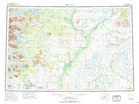
Dillingham sits at the confluence of the Nushagak River and the Wood River, serving as a critical hub for the Bristol Bay region in the early 1950s. This survey illustrates the intricate river-based transport network of Southwest Alaska, where settlements like New Stuyahok and Ekwok are connected by water rather than roads. The map documents the shifting nature of these communities, noting Akokpak and Elilakok as abandoned sites while identifying active post offices at Kvichak and Ekwok.
Find a feature on this map
91 named features on this map. Tap any name to fly to it.
Don’t see what you’re looking for? This feature index may not catch every label — zoom into the map to look around manually.
Map Details
Editions of this 1951 Dillingham Map
This is the sole edition of this map. No revisions or reprints were ever made.