
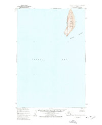
1948 Map of Hagemeister Island C-1
USGS Topo · Published 1977About this map
Walrus Islands rise from the waters of Bristol Bay in this 1948 survey, showcasing a rugged maritime environment where isolated landmasses serve as critical habitats. The primary features of this quadrangle are Crooked Island, with its distinct high-relief terrain reaching elevations over 1,200 feet, and the smaller, prominent Round Island. The entire land area documented here is managed as part of the Walrus Islands State Game Sanctuary, indicating the environmental significance of these outposts even during the mid-20th century.
Find a feature on this map
7 named features on this map. Tap any name to fly to it.
Don’t see what you’re looking for? This feature index may not catch every label — zoom into the map to look around manually.
Map Details
Editions of this 1948 Hagemeister Island C-1 Map
This is the sole edition of this map. No revisions or reprints were ever made.
Other maps of this area

1945 · Nushagak Bay
USGS Topo · 1:250,000

1947 · Hagemeister Island D-2
USGS Topo · 1:63,360
1948 · Hagemeister Island C-2
USGS Topo · 1:63,360

1949 · Nushagak Bay
USGS Topo · 1:250,000

1950 · Nushagak Bay D-6
USGS Topo · 1:63,360

1950 · Hagemeister Island D-1
USGS Topo · 1:63,360

1951 · Hagemeister Island
USGS Topo · 1:250,000

1951 · Nushagak Bay
USGS Topo · 1:250,000

1952 · Hagemeister Island C-1
USGS Topo · 1:63,360

1952 · Hagemeister Island C-2
USGS Topo · 1:63,360