
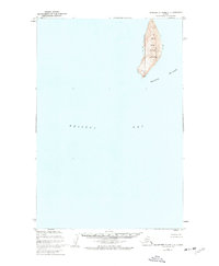
1952 Map of Hagemeister Island C-2
USGS Topo · Published 1955About this map
High Island, a prominent landmass within the northern reaches of the Walrus Islands chain, rises sharply from the waters of Bristol Bay. This 1952 topographic study, compiled from aerial photography and hydrographic surveys, focuses on the isolated geography of the island. The eastern shoreline is defined by a stretch of Sand Beach, while the interior elevation reaches its peak at VABM 1655 High, a primary triangulation station used for geodetic control. The survey also identifies VABM 1546 Az Mark near the southern point, providing essential navigational and surveying data for this maritime region. The map reflects the early post-war effort by the U.S. Coast and Geodetic Survey to accurately chart the remote coastal features of the Alaska Territory.
Find a feature on this map
6 named features on this map. Tap any name to fly to it.
Don’t see what you’re looking for? This feature index may not catch every label — zoom into the map to look around manually.
Map Details
Editions of this 1952 Hagemeister Island C-2 Map
This is the sole edition of this map. No revisions or reprints were ever made.
Other maps of this area

1947 · Hagemeister Island D-2
USGS Topo · 1:63,360

1948 · Hagemeister Island D-3
USGS Topo · 1:63,360

1948 · Hagemeister Island C-3
USGS Topo · 1:63,360
1948 · Hagemeister Island C-2
USGS Topo · 1:63,360

1948 · Hagemeister Island C-1
USGS Topo · 1:63,360

1950 · Hagemeister Island D-1
USGS Topo · 1:63,360

1951 · Hagemeister Island
USGS Topo · 1:250,000

1952 · Hagemeister Island C-1
USGS Topo · 1:63,360

1952 · Hagemeister Island C-3
USGS Topo · 1:63,360

1952 · Hagemeister Island D-1
USGS Topo · 1:63,360