
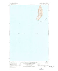
1952 Map of Hagemeister Island D-1
USGS Topo · Published 1955About this map
Ungalikthluk sits along the tidal reaches of the Ungalikthluk River in this coastal Alaskan survey. The landscape is defined by the convergence of the river systems with Togiak Bay, where extensive mudflats and low-lying marshes transition into the waters of Bristol Bay. To the south, the solitary mass of Summit Island stands as a prominent landmark for navigation, marked by triangulation points like VABM Summit 789. The shoreline varies from the tidal flats near the river mouths to the defined Sand Beach and Gravel Beach further east. Inland, the terrain rises toward the mountains, sheltering Nunavachak Lake. The presence of a Cabin near the lake and the settlement at Ungalikthluk suggests the seasonal and subsistence patterns of the region's inhabitants during the early 1950s.
Find a feature on this map
14 named features on this map. Tap any name to fly to it.
Don’t see what you’re looking for? This feature index may not catch every label — zoom into the map to look around manually.
Map Details
Editions of this 1952 Hagemeister Island D-1 Map
This is the sole edition of this map. No revisions or reprints were ever made.
Other maps of this area

1945 · Nushagak Bay
USGS Topo · 1:250,000

1947 · Hagemeister Island D-2
USGS Topo · 1:63,360
1948 · Hagemeister Island C-2
USGS Topo · 1:63,360

1948 · Hagemeister Island C-1
USGS Topo · 1:63,360

1949 · Nushagak Bay
USGS Topo · 1:250,000

1950 · Nushagak Bay D-6
USGS Topo · 1:63,360

1950 · Hagemeister Island D-1
USGS Topo · 1:63,360

1951 · Goodnews
USGS Topo · 1:250,000

1951 · Hagemeister Island
USGS Topo · 1:250,000

1951 · Nushagak Bay
USGS Topo · 1:250,000