
1950 Map of Nushagak Bay D-6
USGS Topo · Published 1956About this map
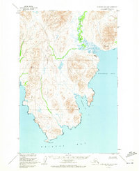
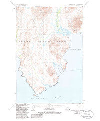
Kulukak (Aband) sits as a quiet landmark on the eastern shore of this coastal Alaskan landscape, documented here during mid-century surveys by the U.S. Coast and Geodetic Survey. The terrain is defined by the significant drainage of the Kulukak River as it empties into the northern reaches of Kulukak Bay. The shoreline is deeply articulated by inlets such as Mete Rvik Bay, terminating at the southern headland marked by Right Hand Pt where the waters meet Bristol Bay. Aerial photography from the late 1940s provided the basis for this topography, capturing a network of high points including Vabm Anyiv 1092 and Vabm Kulukak 656. The map reflects a remote maritime environment where coastal navigation and surveying markers were the primary indicators of human activity and presence.
Find a feature on this map
8 named features on this map. Tap any name to fly to it.
Don’t see what you’re looking for? This feature index may not catch every label — zoom into the map to look around manually.
Map Details
Editions of this 1950 Nushagak Bay D-6 Map
3 editions found
Other maps of this area

1945 · Nushagak Bay
USGS Topo · 1:250,000

1948 · Hagemeister Island C-1
USGS Topo · 1:63,360

1949 · Nushagak Bay
USGS Topo · 1:250,000

1950 · Nushagak Bay D-5
USGS Topo · 1:63,360

1950 · Hagemeister Island D-1
USGS Topo · 1:63,360

1951 · Goodnews
USGS Topo · 1:250,000

1951 · Hagemeister Island
USGS Topo · 1:250,000

1951 · Nushagak Bay
USGS Topo · 1:250,000

1952 · Hagemeister Island C-1
USGS Topo · 1:63,360

1952 · Hagemeister Island D-1
USGS Topo · 1:63,360