
1947 Map of Hagemeister Island D-2
USGS Topo · Published 1975About this map
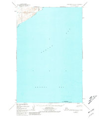
Togiak Bay and the vast expanse of Bristol Bay dominate this 1947 hydrographic study, showing the coastal interface where the Quigmy R meets the sea. The map reflects a period of intensive charting by the U.S. Coast and Geodetic Survey, which utilized aerial photography and a Reading plotter to delineate the intricate shoreline and inshore details. A single prominent landform, High Island, stands near the southern boundary, surrounded by soundings that indicate the varying depths of these subarctic waters. The lack of roads or established trails in the northwest corner highlights the wilderness character of the region during the post-war era, as the Bureau of Land Management worked to survey these unmarked territories.
Find a feature on this map
4 named features on this map. Tap any name to fly to it.
Don’t see what you’re looking for? This feature index may not catch every label — zoom into the map to look around manually.
Map Details
Editions of this 1947 Hagemeister Island D-2 Map
2 editions found
Other maps of this area

1948 · Hagemeister Island D-3
USGS Topo · 1:63,360

1948 · Hagemeister Island C-3
USGS Topo · 1:63,360
1948 · Hagemeister Island C-2
USGS Topo · 1:63,360

1948 · Hagemeister Island C-1
USGS Topo · 1:63,360

1950 · Hagemeister Island D-1
USGS Topo · 1:63,360

1951 · Goodnews
USGS Topo · 1:250,000

1951 · Hagemeister Island
USGS Topo · 1:250,000

1952 · Hagemeister Island C-1
USGS Topo · 1:63,360

1952 · Hagemeister Island C-3
USGS Topo · 1:63,360

1952 · Hagemeister Island C-2
USGS Topo · 1:63,360