1947 Map of Hagemeister Island D-2
USGS Topo · Published 1981About this map
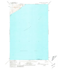
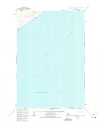
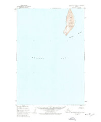
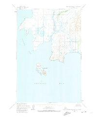
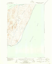
Walrus Islands State Game Sanctuary occupies the southern reaches of this maritime survey, centered around the solitary landmass of High Island. Based on data from the U.S. Coast and Geodetic Survey, the map details the expansive waters where Togiak Bay meets Bristol Bay. Along the northern shoreline, the mouth of the Quigmy R enters the bay near the established Togiaak Corp Bdy. The topography is primarily focused on the coastal interface, illustrating the tidal flats and depths of these remote Alaskan waters as they were charted shortly after World War II. The sparse inland detail emphasizes the significance of the coastline and offshore islands for navigation and wildlife conservation in the Bering Sea region.
Find a feature on this map
6 named features on this map. Tap any name to fly to it.
Don’t see what you’re looking for? This feature index may not catch every label — zoom into the map to look around manually.
Map Details
Editions of this 1947 Hagemeister Island D-2 Map
2 editions found
Other maps of this area
1947 · Hagemeister Island D-2
USGS Topo · 1:63,360
1948 · Hagemeister Island D-3
USGS Topo · 1:63,360
1948 · Hagemeister Island C-3
USGS Topo · 1:63,360
1948 · Hagemeister Island C-2
USGS Topo · 1:63,360

1948 · Hagemeister Island C-1
USGS Topo · 1:63,360
1950 · Hagemeister Island D-1
USGS Topo · 1:63,360

1951 · Goodnews
USGS Topo · 1:250,000
1951 · Hagemeister Island
USGS Topo · 1:250,000
1952 · Hagemeister Island C-1
USGS Topo · 1:63,360
1952 · Hagemeister Island C-3
USGS Topo · 1:63,360